• About Me

Cycle Seattle

~ Posts on bikes

Cycle Seattle

Tag Archives: Hunqapillar

Image

Whidbey Island Out(n)Back

25 Thursday Aug 2016

Tags

bicycle, bike, Chocomoose, cycling, Ebey's Landing, Fort Ebey, Greenbank Farm, harlequin wrap, Hunqapillar, rivendell, Whidbey Island


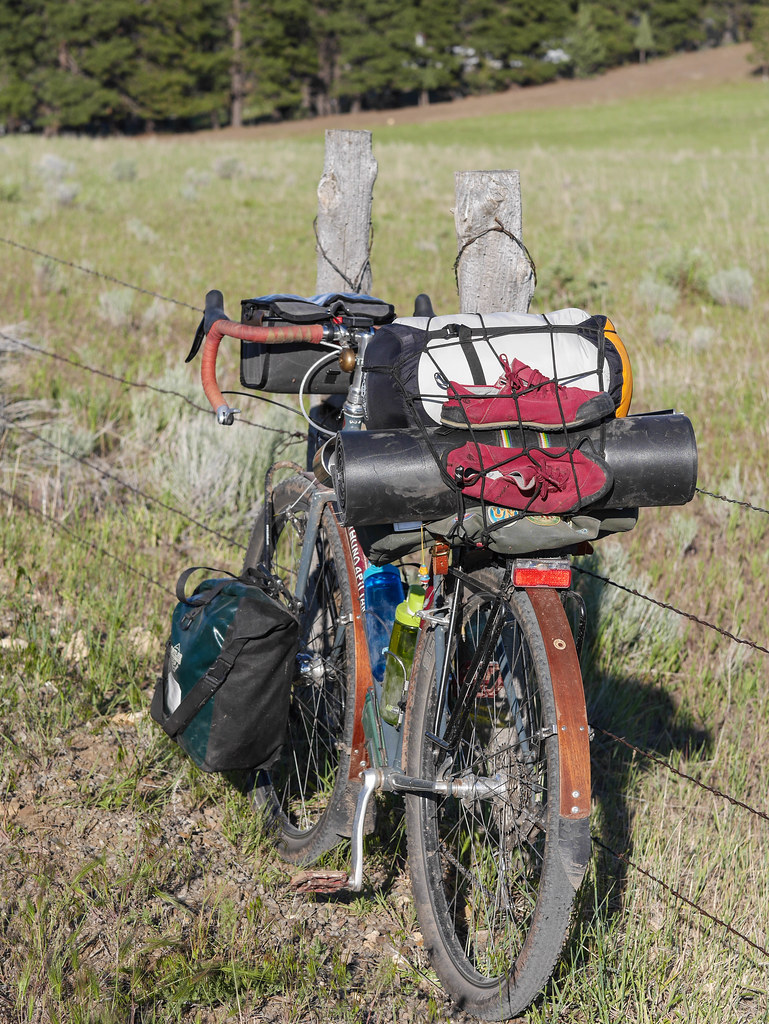
Not much action on the camping front this year, so I grabbed a chance to do a quick overnight (S24O) from my place in Freeland, WA up to Fort Ebey.  It’s about 30 miles one way, and a great chance to try:

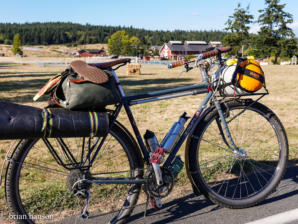
  1. Hunqapillar on singletrack
  2. New road exploring
  3. Hammock camping

This also echoes the distance of a Lake Crescent trail I want to do later this year.  That gig is mostly singletrack, but I would use the same equipment.

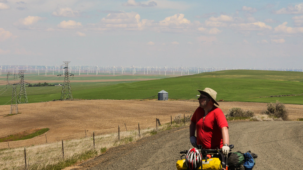
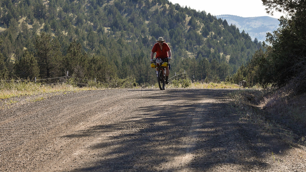
I got underway around 4:45pm on Monday.  I figured it would take 2-3 hours, so I would likely have light to set up camp.  John and I had explored Fort Ebey’s mtb trails a few days earlier, so I knew where the hike/bike campsites were.

stonehog-2.jpg

The Gunnar Point – a family photo tradition going back 50 years

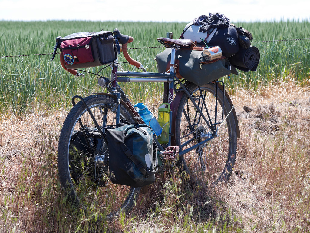
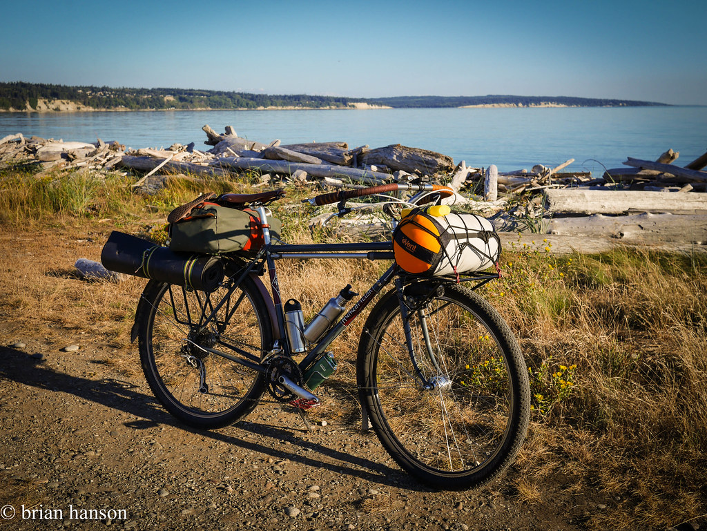
I packed light. There was a burn ban, so I didn’t bother bringing a stove. Just 2 water bottles, a toaster pastry for breakfast, and a can of salmon for dinner. Easy. I wore the clothes on my back and brought along a pair of wool long underwear for sleeping. No rain in the forecast. Other than that, just my hammock, fly, sleeping bag and roll. Oh yeah – I strapped some sandals on, in case the feet got sore, but that was just unused extra weight. I think the whole thing weighed in under 10 pounds.


stonehog-4.jpg

Loaded at Greenbank Farm

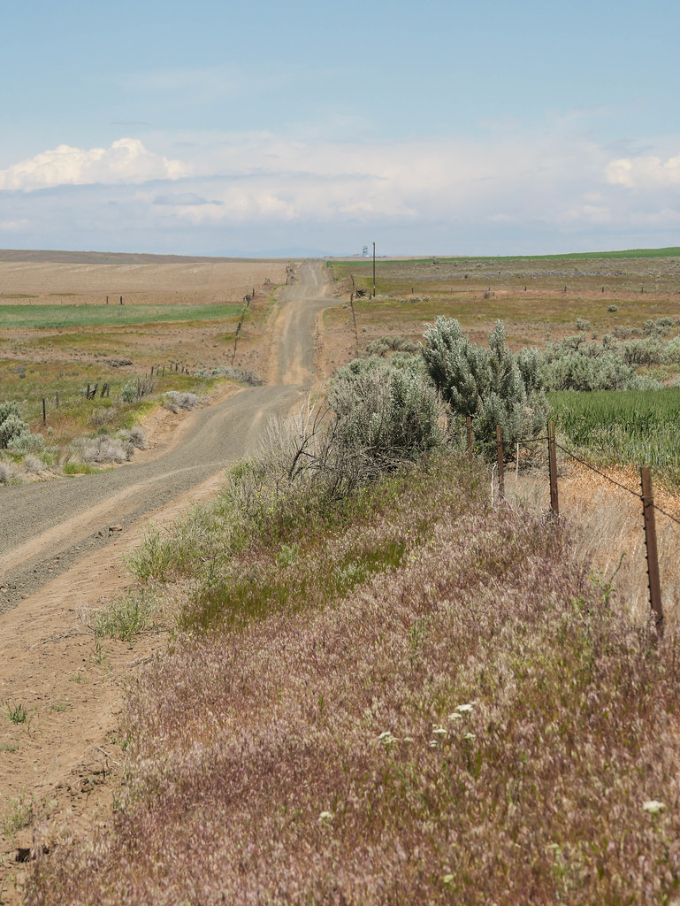
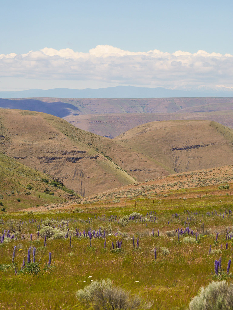
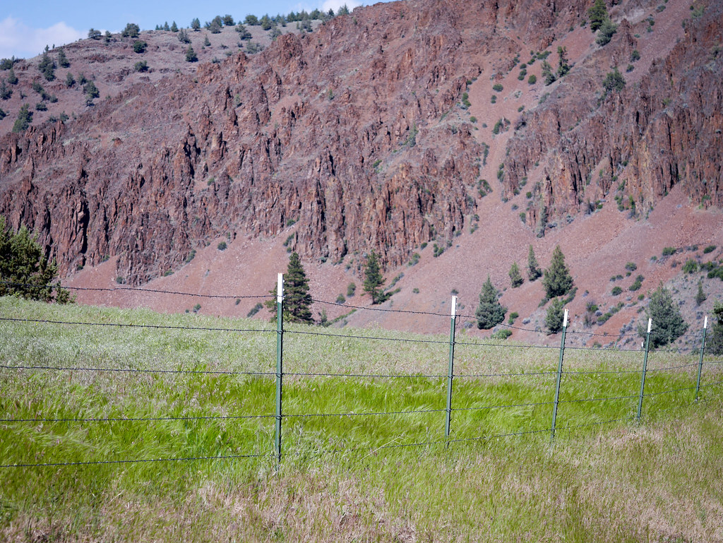
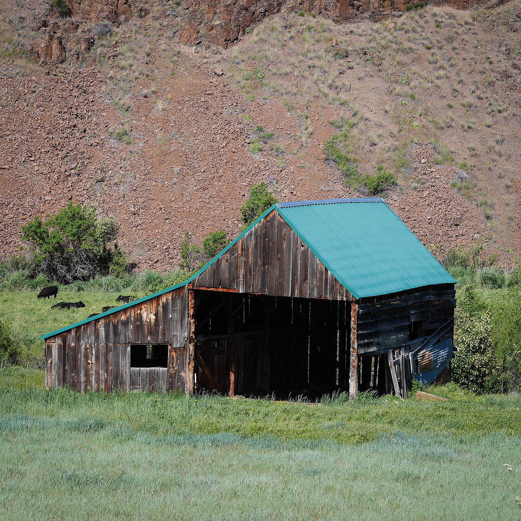
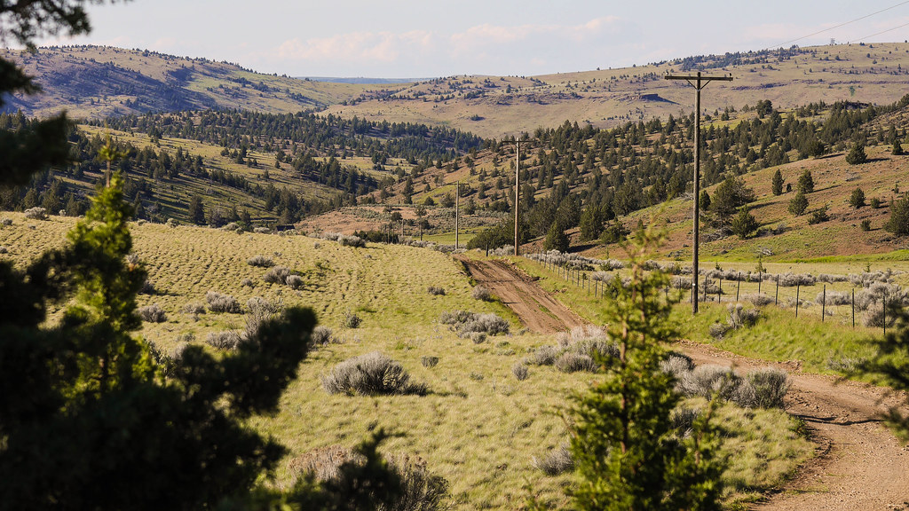
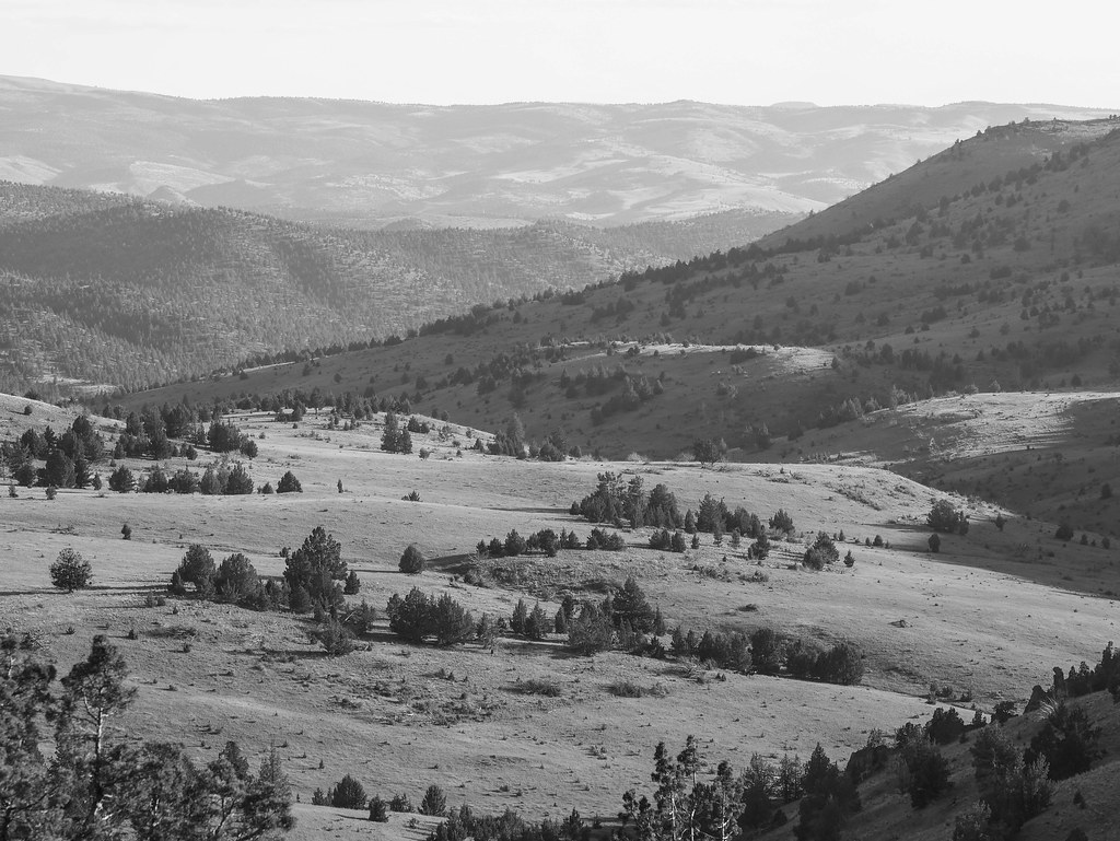
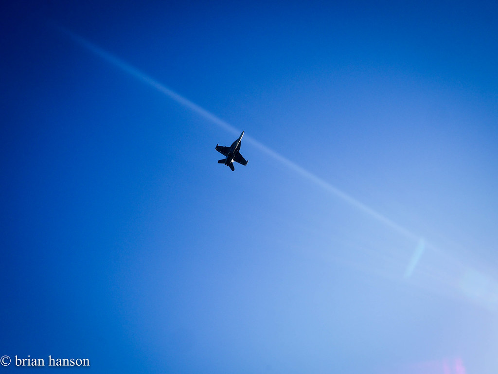
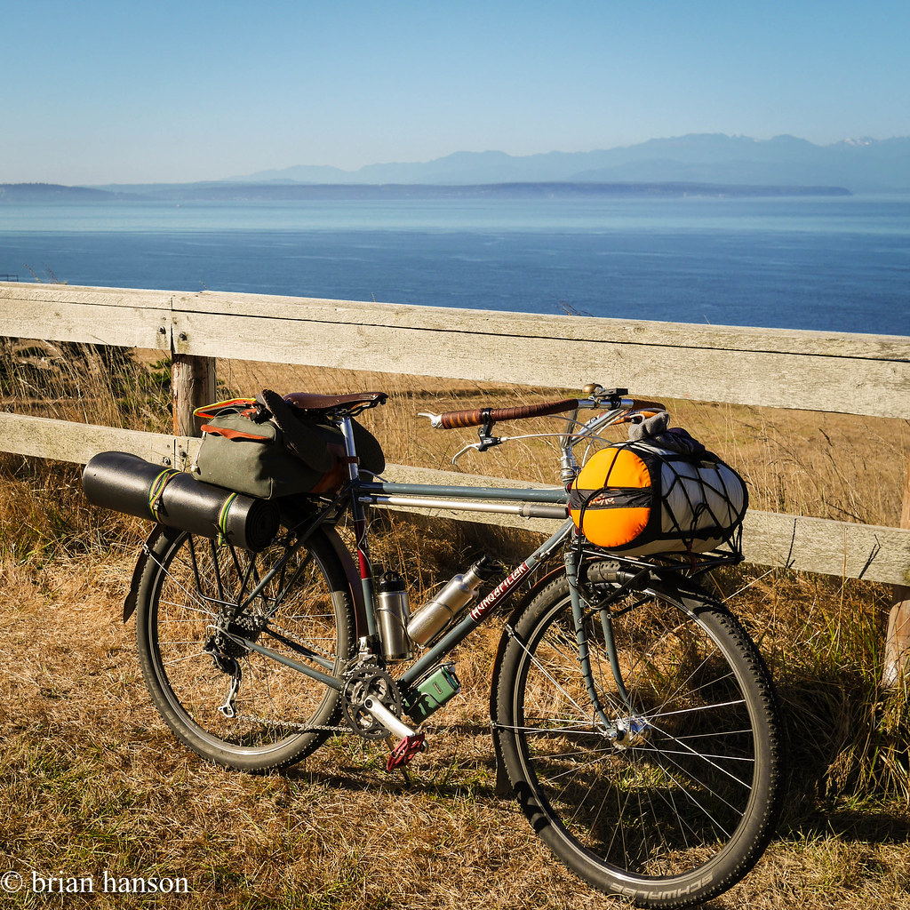
The way up was stunning and uneventful. Heading north, I passed South Whidbey State Park, and Greenbank Farm. The stretch from Greenbank up to Coupville had some great hills and views, and the Navy Growlers were out practicing on the outlying field near Admirals Cove.

stonehog-5.jpg

Growler Practice


stonehog-6.jpg

Keystone Spits

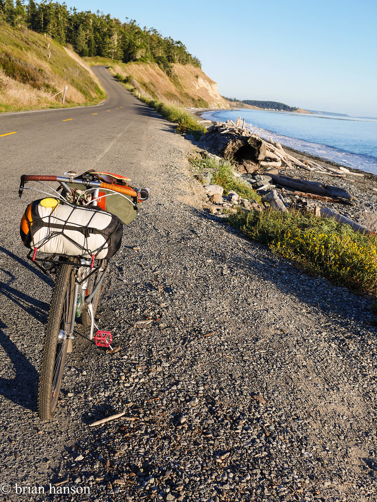
The long stretch across Keystone to Fort Casey yielded a few seals and many sea birds, but I saw not much traffic on a Monday night.

stonehog-8.jpg

Road to Keystone

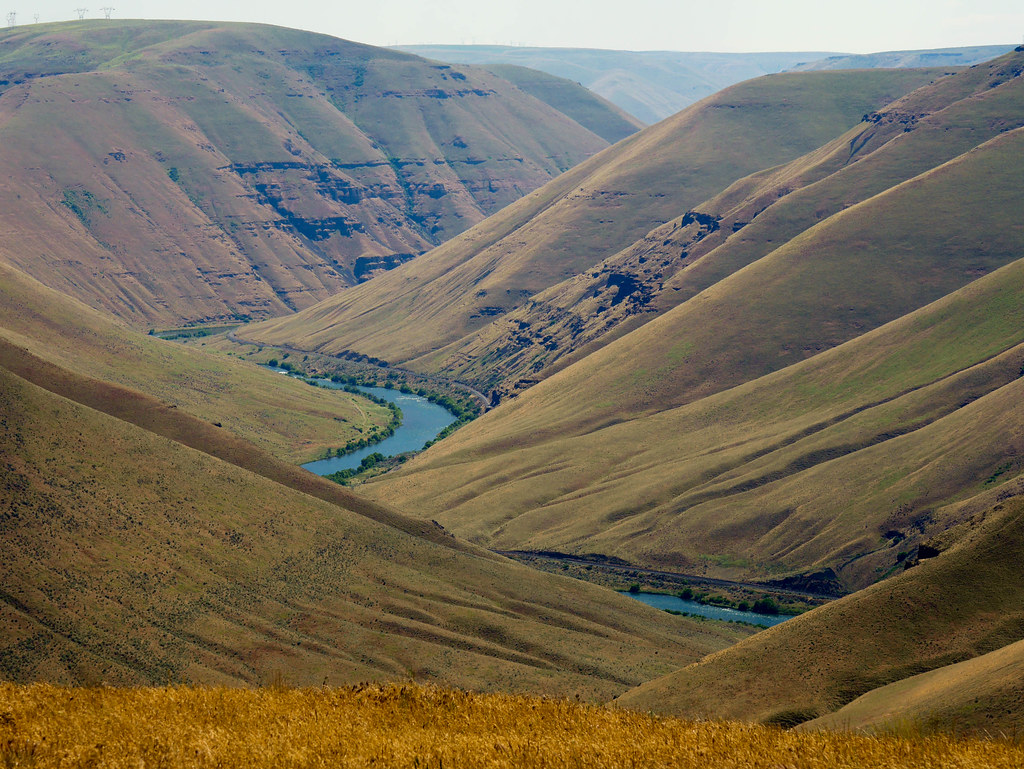
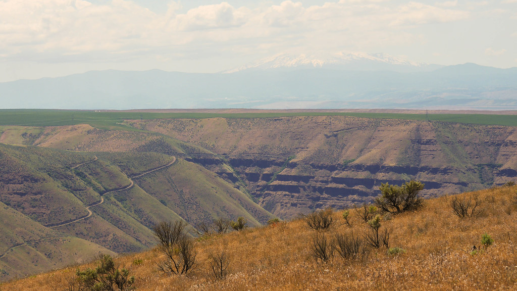
I searched through Fort Casey for a back route, and thought I had it following a gravel trail by the lighthouse, but it ended in a private road. I left it to chance, and wasted a few minutes, but it was worth the views.

stonehog-9.jpg
stonehog-10.jpg 
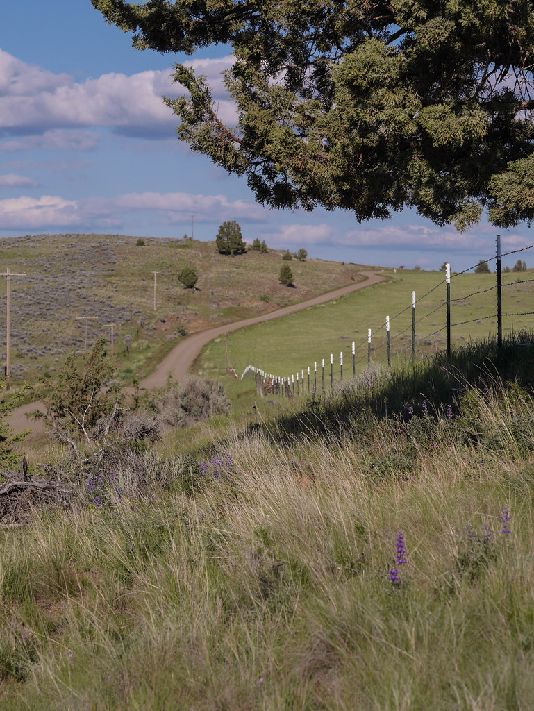
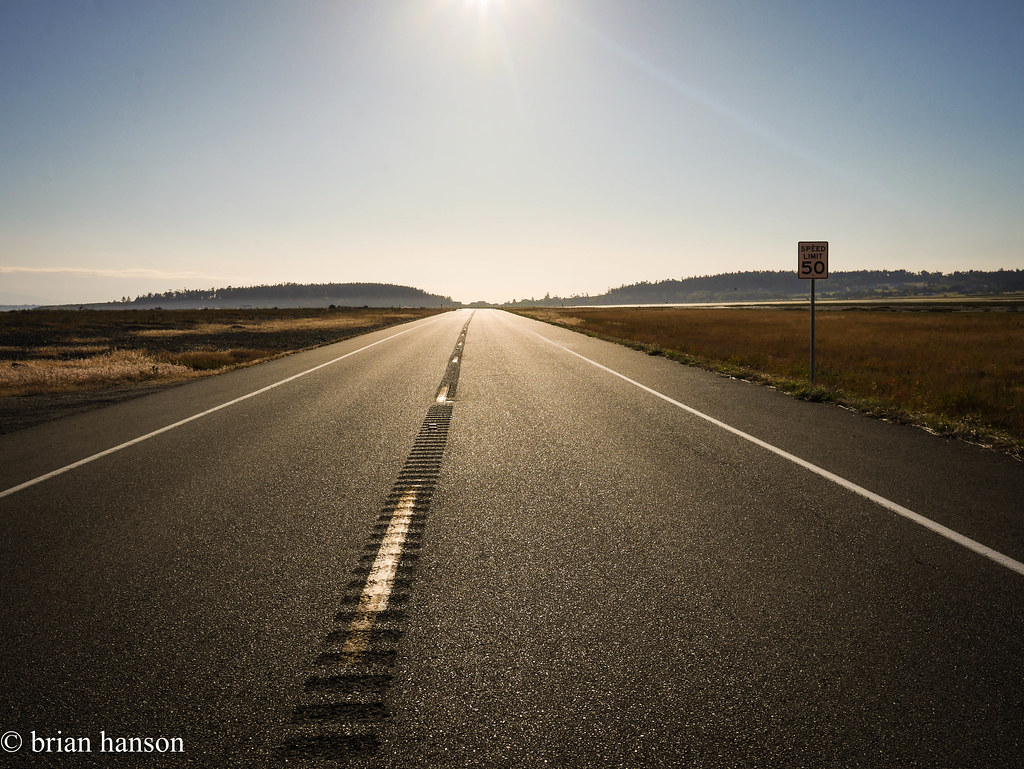
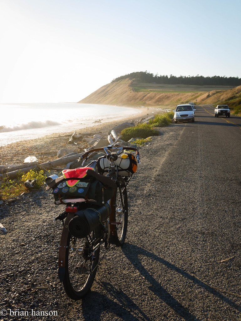
The road down to Ebey Beach is amazing – no shoulder, but equally no cars.
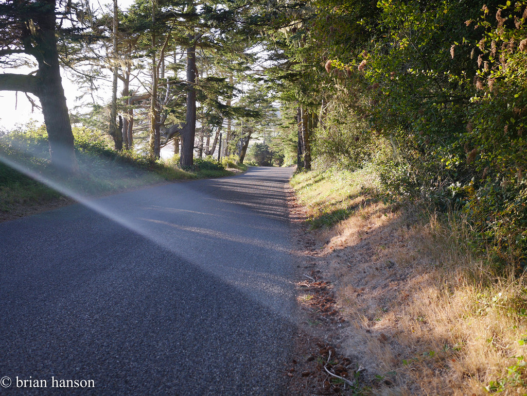
stonehog-11.jpg

Sunbeam!


stonehog-12.jpg

Looking South…


stonehog-13.jpg

And North to Ebey’s Landing…

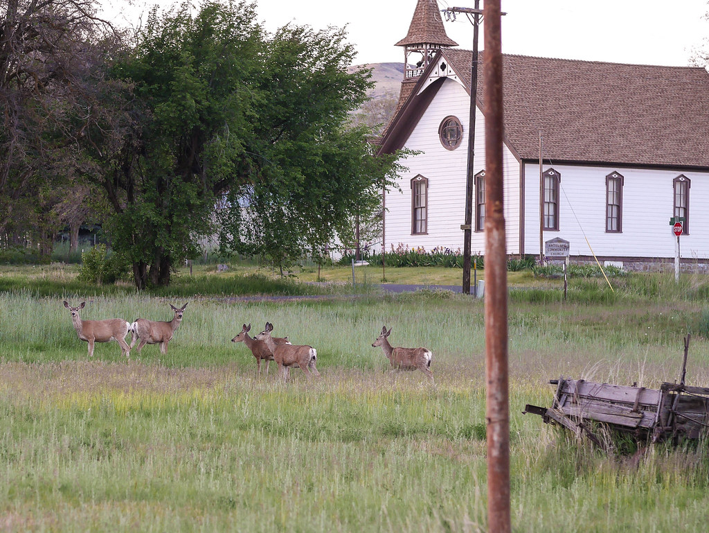
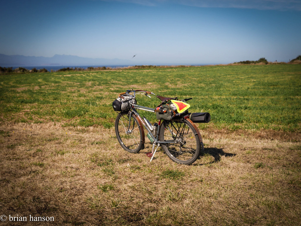
After a short hop up to the bluff, and across an amazing open farming area, it was a quick ride to the new pavement of Madrona Way past the mussel farms in Penn Cove.


stonehog-14.jpg

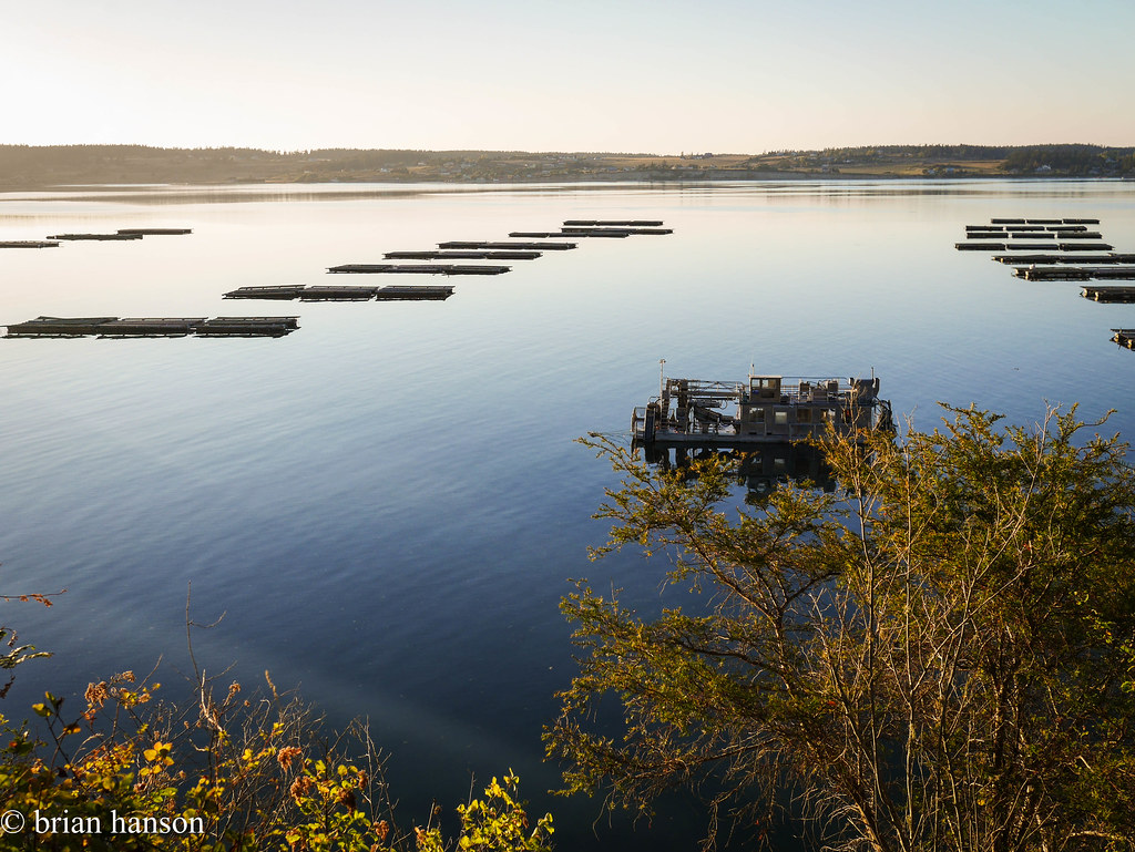
Penn Cove Mussels come from here!

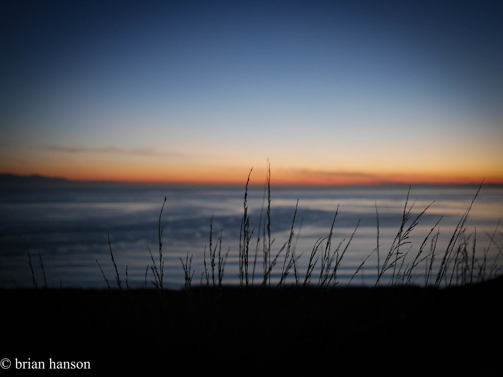
At this point, I was starting to worry about sunlight – it had taken me about 2 1/2 hrs to get this far. I hurried on into Fort Ebey State Park, and set up the hammock. There was one other person in the hike/bike spot – a Pacific Northwest Trail through hiker. After a dinner of canned salmon on the bluff overlooking the Straights of Juan de Fuca, and a great sunset, it was off to bed.

stonehog-15.jpg

Good night!

The next morning was sunny, so I geared up and chatted with the hiker to learn about his journey. He was a 65 years old Granite Falls, WA resident, and 7 weeks into the trail that started in Glacier National Park. After 8 bears (one grizzly at about 10 yds), a pack of wolves, and countless coyotes, he was just heading to the ferry to Port Townsend to have a lunch reunion with his wife before finishing the last 150 miles to Cape Alava.

stonehog-17.jpg

Ready for the trip home

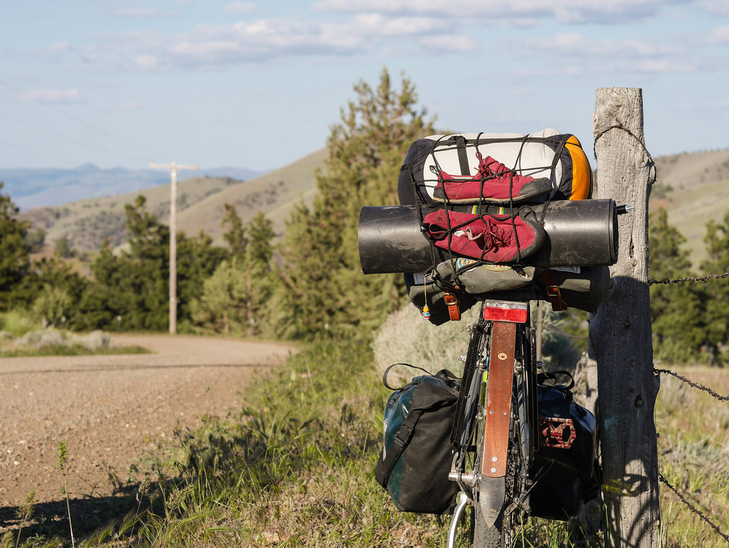
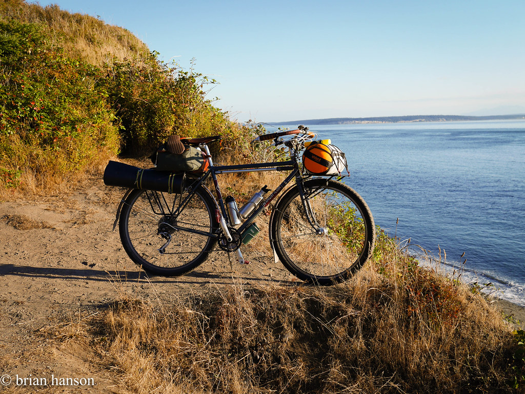
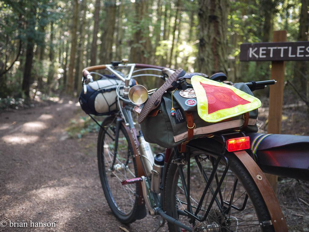
After a nourishing breakfast at the same scenic overlook on the bluff and a water bottle refill, I was off to ride the Kettles trail on the loaded Hunq!

stonehog-18.jpg

MTB Riv Style

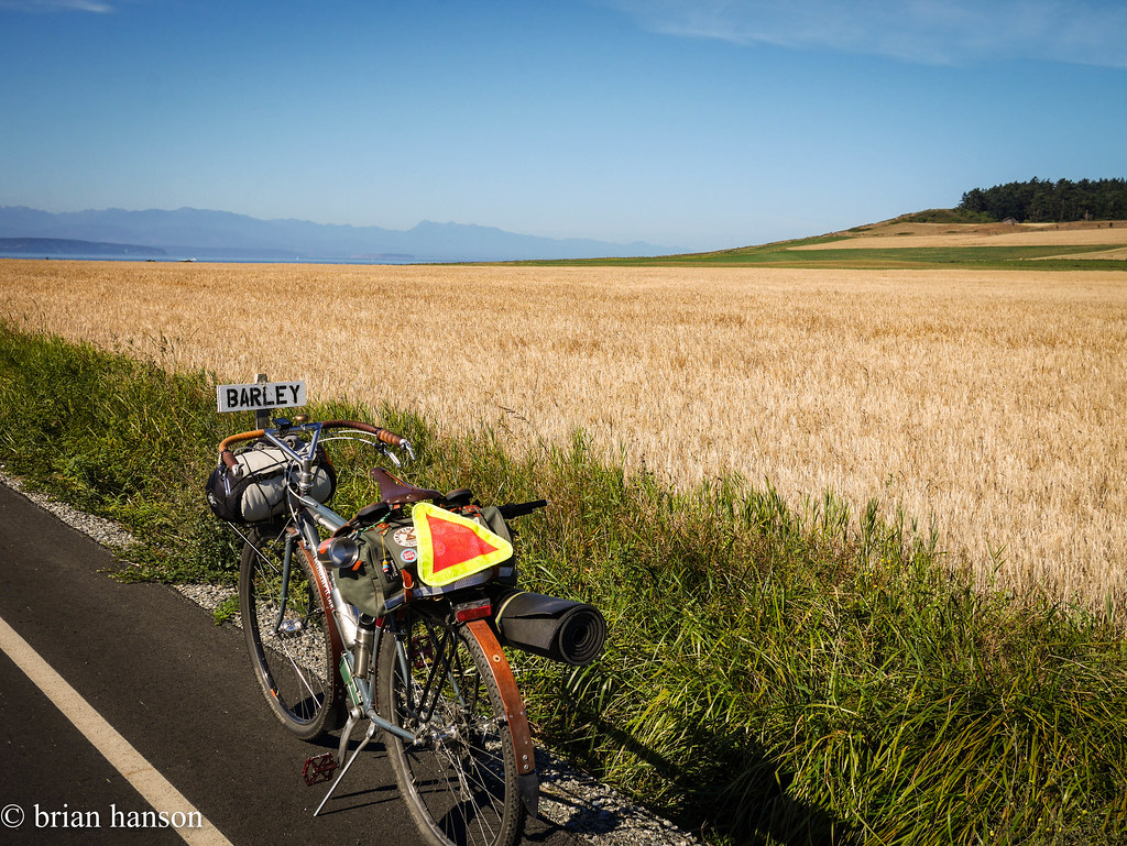
Needless to say, the Hunq made short work of the trail, and I found myself heading back south and past the barley fields to Ebey Beach.

stonehog-21.jpg

At the whisky source

stonehog-24.jpg

stonehog-22.jpg 
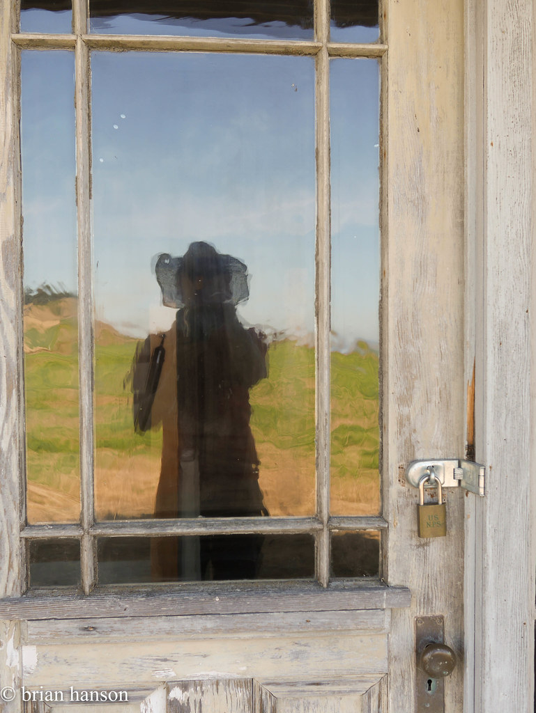
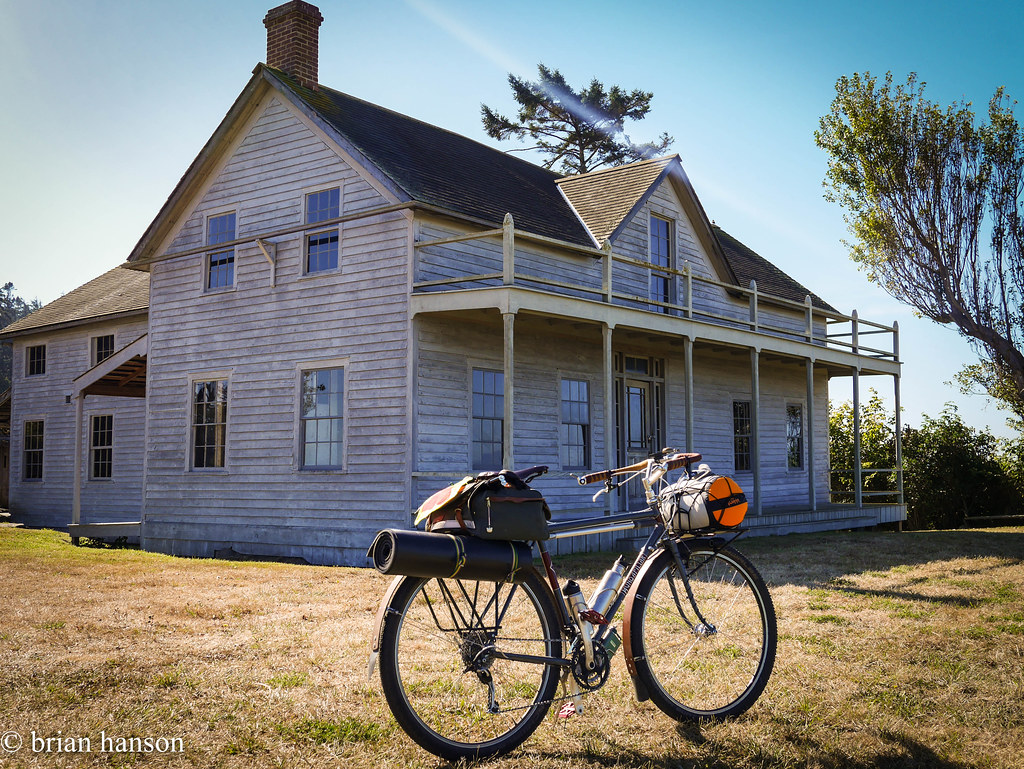
I stopped at the old “Ferry Building” on the bluff to explore and take some pics, then it was back down to Keystone, Greenbank, and finally back to Freeland for some rest and a meal. stonehog-28.jpg

stonehog-27.jpg

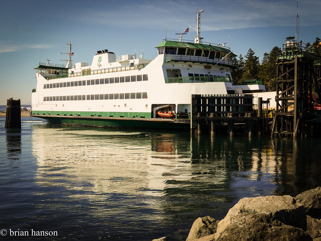
Route out and back are here:

http://cyclemeter.com/51cfa6724f84c700/Cycle-20160822-1639

http://cyclemeter.com/51cfa6724f84c700/Cycle-20160823-0934
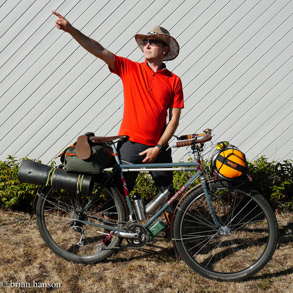
Ebey trip out

Posted by Stonehog | Filed under Bikepacking, Cycling, Enduro Offroad, MTB, Northwest

≈ 3 Comments

Image

Bar Width and Handling

09 Saturday Jan 2016

Tags

albastache, albatross, bar width, bikepacking, cycling, ergonomics, handlebar, Hunqapillar, leverage, low-trail, nitto noodles, rivendell, steering


As a follow up to my post on trail, this is a related experiential review on the role of bar width and the interaction with trail.  This may impact someone’s decision on whether high or low trail is right for them by basing it on one’s comfort with wide or narrow bars.  It also may impact the decision based on what you will be using the bike for, and where you plan to do most of your riding.

Low trail is great with narrow bars

On my Vélo Routier, having narrow bars is comfortable, and I have no problem putting feedback into steering even at higher speeds.  I currently use 42cm Noodles, and have plenty of control.

Higher trail is great with wider bars

Wide bars (48cm and wider) work very well on higher trail bikes.  They give you the leverage you need to turn during even an “in the rails” higher speed maneuver.

The further away from your steering axis you have your hands, the more they will have input on steering – this is true for any bike and any amount of trail.  To get a consistent steering input impact and feel, you should be able to compensate for higher trail with wider bars.

Adding bar width to compensate for trail will keep steering input feel approximately equivalent//embedr.flickr.com/assets/client-code.js

This is why offroad motorcycles/bicycles have wide handlebars, and most city or road motorcycles/bikes tend to have narrow bars.  Big generalization here, but I have definitely noticed this on several occasions. This is not really a discussion based on rider ergonomics and comfort, but a general handling conversation.  If you are a rider that needs a wider or narrower bar, it may help to understand how that will impact handling based on what trail geometry your bike has.

Real World Example

In prep for my last adventure, I wanted drop bars due to the length and time I would be in the saddle.  The Oregon Outback, at 360 miles and mostly dirt roads, would be an endurance test.  I wanted the most hand positions possible, and had done long rides in drops with plenty of comfort.  I used 44cm Noodles on my mid/high trail Hunqapillar with the thought that they would add a bit of leverage, but be very close to my “perfect” rando bar, the 42cm Noodle.

Reality was a bit different.  While I was plenty comfortable with the bars, and had no hand numbness or pain, there were several times where I wished for more leverage.  The amount of weight I had on the bike made these bars too narrow for the dirt trails.  I had to put a lot more effort into keeping the bike tracking at low speeds and up hills.  This was less noticeable when I was on nicely paved sections, but the dirt roads added difficulty.

On the fast downhills, the gyro effect tended to add to the effort required to steer.  I was hit by an incredible wind gust at the very bottom of a 30+mph descent near the end of the ride, and I barely escaped launching off the side of the dirt road.  If I hadn’t been near the middle of the road, it would have been grim – the bike tracked me all the way to the far edge before I got enough muscle into keeping on the road.

Lesson – I’m putting a wider bar on this bike.  Likely either the new Choco bars from Rivendell, or the Albatross/stache bars I’ve used in the past.  A nice Jones H-bar would be great, as well, providing even more leverage and plenty of hand positions.

BH-88.jpg

44cm – a bit too narrow

BH-9.jpg

55cm – just right

Posted by Stonehog | Filed under Cycling, Enduro Offroad, Northwest, Randonneuring

≈ 3 Comments

Image

…vrrrrrp – OK

16 Monday Nov 2015

Tags

a. homer hilsen, commute, Cycles Toussaint, cycling, hilsen, Hunqapillar, Oregon Outback, randonneur


Untitled

Getting back on the blog. It’s been a long hiatus since my last post on June 11th?? Wow – I feel lazy. What’s been going on since May/June? I guess I’ve been low-key biking, working, and occasionally kayaking. No big bike trips this summer. The closest thing has been a brief bike around Amsterdam in October, but I’ve literally done zero rando events this year. Ironic as it was a PBP year. Well – there will be others. I’ve still got a few stories to get out, such as:

  • What worked on the Oregon Outback
  • How is that Velo Routier doing these days?
  • What about the Homer and the Hunqa??
  • Food and clothing thoughts
  • Soma (old brand) single speed conversion (maybe)

OK – got that out of my system.

Posted by Stonehog | Filed under Cycling, Northwest

≈ 6 Comments

Oregon Outback 2015 – Day 5

11 Thursday Jun 2015

Posted by Stonehog in Cycling

≈ 2 Comments

Tags

Deschutes River, Gordon Ridge, Hunqapillar, Oregon Outback, Shaniko, Thunder Burts, Windmills


Ghostly towns and grand vistas


The roosters brought us back to life after the long day before, and I got up and took some morning pics of Shaniko.  As we arrived in the dark, I didn’t get a good look at the surroundings until I got up.  It was a pretty amazing old west town that was fairly well preserved.

BH-97.jpg

BH-98.jpg

BH-99.jpg

BH-100.jpg

BH-101.jpg

BH-104.jpg

The wagon yard we camped under was like a central covered picnic area in the middle of an old west museum.

BH-105.jpg

We got ourselves packed and watered up, and after the usual oatmeal breakfast, we were off. The initial 15 miles went fast as we blasted out along US97 on fast slightly downhill pavement. The tires really showed their zeal – Thunder Burts are fast. We did 20 mph in an easy pace line. That all changed when we reached the first dirt road, however…

BH-110.jpg
– Our day ahead

BH-109.jpg
– Always in view

Oregon Outback Complete!

The roads were slightly less worn on this final day, so there was a lot of loose gravel. Almost zero traffic, however. The terrain was heavily rolling – something lost on the elevation profile of our route which looked flat and dropping. There were many small hills, and the route was totally exposed.

We had planned to find a drop down to the Deschutes somewhere on the route, but I started out tentative towards this plan, and didn’t get more confident as the day wore on. Our lunch stop was not really in a memorable area – merely on the side of a farm road next to a site common to this midwesterner:

BH-111.jpg
– Cow fodder

BH-112.jpg
– Nary a tree in sight

As we approached the Columbia gorge, the land kept a rollin’, and the heat kept a heatin’ us. I found myself wondering how the racers felt doing this stretch after 30 hours of pedaling straight through. Seeing hill after dusty hill and knowing the finish was near must have been exhilarating and frustrating to no end.

BH-113.jpg
– Trusty dusty steed

We started getting into some views of the Deschutes River valley that we had been paralleling for tens of miles, and the flowers came out. The scenery was notching up, again.

BH-115.jpg

Gordon Ridge was the last obstacle in our path to the Columbia.

BH-116.jpg
– We’ve gotta climb that??

It was an imposing beast that only rose 400ft above us, but with some 10% grades, it was arduous.

BH-119.jpg

Once at the top we were treated to some great views north – lots of windmills, and volcanic peaks to the north and south east.

BH-118.jpg
– Clean Power

BH-117.jpg

The next section was thrilling and terrifying at times. The ridge road dropped away riding along the edge of the steep valley walls that fell away 2000 feet to the river below. Several 40 mph runs had us hooting like kids. I was sandblasted by a dust devil, and caught a nasty sidewind that hit me unexpectedly at a turn at the bottom of a fast run, blowing me several feet sideways in loose gravel (luckily I was in the middle of the road). I quickly reminded myself to ride loose and not clench as the loose gravel on these descents didn’t reward a controlling demeanor.

BH-120.jpg
– The sacred Deschutes

At this point, we came to the turnoff we had planned to take down to the Deschutes.  It was marked “no trespassing”, and I felt pretty bagged.  We made the decision to continue on the normal route so we wouldn’t have to push our bikes up 2000 feet if the route got nasty.  I think another trip is in order to explore the area on fresher legs.

BH-121.jpg
– Hidden volcano

By the time we hit OR 206, the final stretch of paved road to the river, I was beginning to feel elation and sadness that our trip was nearing its end. There were still some memorable views, and we fairly flew down the final thousand foot drop, albeit slowed to pedalling speed due to the relentless headwind rushing up the canyon to meet us.

BH-122.jpg
– Almost there

Once at the river, we decided to forego the campground for a meal in nearby Biggs. As we pedaled east, John had the light come on. “They have hotels in Biggs! We can get food, a shower, and a good night’s sleep!” Genius! Our adventure had come to an end, but there will certainly be more of this!

Post Outback
– Post Outback Selfie

Route Map – Day 5 (final)

45.003736 -120.752267

Oregon Outback 2015 – Day 4

10 Wednesday Jun 2015

Posted by Stonehog in Cycling

≈ 1 Comment

Tags

Antelope, Ashwood, bicycle, Big Bend, bike touring, Gosner Rd, Gravel Touring, Hunqapillar, McKay, Oregon Outback, Prineville, thunder burt, Trout Creek


This was a day of big breakfasts, big climbs, big miles, and some of the best riding and views of the trip.  My favorite day hands-down.

20 miles out of Big Bend campground, Prineville was the only “large” town we went through in our five days. We were drawn to the first diner we came to on Main St. My eyes were only a bit larger than my stomach.

Prineville Breakfast - Oregon Outback
– Yes, had to have the buckwheat pancakes, too!

BH-62.jpg
– Yummm!

BH-61.jpg
– 4 days in and still happy!

After eating our fill, we stopped at the grocery, and realized we still had plenty of food for dinner and lunch. I think we picked up more gorp, string cheese, and some Tylenol. I was starting to get a good picture of how over-packed we were.

The local bike shop was closed, so we couldn’t stop in for the legendary beer we heard about from other riders. Sad face…

Onward. Approaching the first big climb of the day around mile-25, the scenery was really turning out well.

BH-63.jpg
– Green Ranches

This climb was paved, but rose about 2200 feet over 17 miles.  Not too taxing – still early in the day, and at the top we rested with a few riders and compared tires and notes.

BH-65.jpg
– The beginning of FUN

The next 10 miles were amazing.  We were doing 25+ mph gravel switchbacks down Little McKay Rd.  Loads of fun – edge of control with loaded touring bikes.  At Trout Creek Rd, the route degraded to jeep road, more or less, and we ran into the creek crossing the road at least 5 times – sometimes 5-10″ deep, but at most 10-15 yds across.  The first time was a circus with a large group of 5-10 folks hanging out taking pics and refilling water bottles.  We did the same.  I did a quick song and dance for Sprockets Podcast (one of the riders had a mic and was doing impromptu interviews of OO riders).

BH-71.jpg
– Made it!

One of the riders in the crew was doing it on a Yuba carrying a hibachi grill. Awesome!

BH-72.jpg
– Long tail bike madness

The next crossing was deeper, and we hit it faster. My panniers managed to put up a blanket of water spray that soaked me thoroughly. In darker news, the rocks managed to kill my cameraman’s front Thunder Burt with enough of a pinch flat cut that the Stan’s sealant was of no use. Tube time.

BH-74.jpg
– Spray!

BH-75.jpg
– Made it!

The next guy through – a solo rider from Seattle – managed to double flat. This was after a single flat in the last crossing. We spent the next 45 minutes putting a tube in John’s front wheel, and helping the other rider out.

BH-76.jpg
– 3 flats in 3 minutes

Needless to say, we were more careful on the last few crossings, walking several. Hey – the shoes were already wet…

BH-77.jpg
– Care must be taken

The rest of the descent was uneventful, if not a bit roller-coastery. I later mused that this was my absolute favorite part of the ride. Remote and scenic.

BH-81.jpg

BH-82.jpg

BH-83.jpg

Nearing the bottom of the valley, we approached Ashwood through Fools Hollow and Slaughterhouse Gulch, (yes – look it up), what looked like a small town turned out to be about 5 houses, a short few hundred yards of pavement, and then a wall of a climb out of the valley on a gravel road just outside of “town”. Gosner road was a 500 foot climb with 8-12% grades, and it was fairly brutal after all that nice downhill progress. At some point, I tried hopping off and walking, but I quickly found that harder with a fully loaded bike than just sucking it up and pedaling in the easy gear.

BH-84.jpg
– John breaches the first rise out of Ashwood

Thus began our quest to get over the latter two 1000-foot climbs of today’s route. I kept thinking we must have done it, but we would just come to another rise. I started to view climbs in a different light. I found myself hoping that the next corner would just reveal more climbing instead of relief, as I wanted to get the vertical I knew we had coming. It turned almost meditative with me concentrating on nose breathing, and just pushing on. Really kind of peaceful.

BH-85.jpg
– Roads to somewhere

Again we rolled through some amazing western scenery. I think we saw 2 cars this whole stretch, and fewer riders. The terrain was continuously rolling and slightly brutal after the long day’s riding, but so pretty that it kept things interesting. We were constantly looking for trees now as it was our normal camp time, but alas, we were not finding much to hang a hammock on that was on the right side of the fences.

BH-87.jpg

BH-89.jpg

BH-92.jpg

BH-94.jpg

As we broke through the long descent into Antelope, I looked longingly at the city park with its big cottonwoods (slightly too big to put a hammock on). We only saw a herd of deer – we could hear music playing in one of the local homes, but no people were out.

BH-95.jpg
– Nobody home?

BH-96.jpg
– More citizens

With about 10 miles to go before our Shaniko camping destination, we at last hit the final 1000-foot climb. It was paved at least, but just as steep as the hills before. We rolled into Shaniko after a final paceline drive into the darkening sky. The kind folks who got there before us had saved some community food donated by a women from the local post office. I had some wheat thins and Spam, and John had a PB&J. We tied our hammocks to the posts sheltered by an old “wagon house” structure, and slept soundly. At nearly 100 miles and 7300 feet of climbing, it was our toughest, but most rewarding day.

Route Map – Day 4

44.910682 -120.722817
← Older posts

Flickr Photos

BH-19.jpgBH-18.jpgBH-17.jpgBH-16.jpgBH-15.jpgBH-14.jpgBH-13.jpgBH-12.jpgBH-11.jpgBH-10.jpg
More Photos

Archive

  • August 2020 (1)
  • March 2018 (1)
  • January 2018 (1)
  • July 2017 (1)
  • June 2017 (1)
  • May 2017 (1)
  • February 2017 (1)
  • December 2016 (1)
  • November 2016 (1)
  • August 2016 (2)
  • March 2016 (1)
  • January 2016 (6)
  • December 2015 (2)
  • November 2015 (1)
  • June 2015 (5)
  • May 2015 (1)
  • April 2015 (1)
  • March 2015 (2)
  • January 2015 (2)
  • December 2014 (2)
  • November 2014 (2)
  • October 2014 (2)
  • September 2014 (2)
  • August 2014 (1)
  • July 2014 (1)
  • June 2014 (1)
  • May 2014 (2)
  • April 2014 (5)
  • March 2014 (4)
  • February 2014 (4)
  • January 2014 (6)
  • December 2013 (1)
  • November 2013 (2)
  • October 2013 (2)
  • September 2013 (1)
  • August 2013 (1)
  • July 2013 (2)
  • May 2013 (6)
  • April 2013 (1)
  • March 2013 (6)
  • February 2013 (2)
  • January 2013 (7)
  • December 2012 (5)
  • November 2012 (2)
  • October 2012 (2)
  • September 2012 (3)
  • August 2012 (3)
  • July 2012 (1)
  • June 2012 (4)
  • May 2012 (7)
  • April 2012 (1)
  • March 2012 (1)
  • February 2012 (4)
  • January 2012 (5)
  • December 2011 (6)
  • November 2011 (4)
  • June 2011 (2)
  • May 2011 (4)
  • March 2011 (2)
  • February 2011 (4)

Enter your email address to follow this blog and receive notifications of new posts by email.

Join 95 other subscribers

Blog at WordPress.com.

  • Follow Following
    • Cycle Seattle
    • Join 95 other followers
    • Already have a WordPress.com account? Log in now.
    • Cycle Seattle
    • Customize
    • Follow Following
    • Sign up
    • Log in
    • Report this content
    • View site in Reader
    • Manage subscriptions
    • Collapse this bar
 

Loading Comments...