• About Me

Cycle Seattle

~ Posts on bikes

Cycle Seattle

Blog Archives

Image

Oregon Outback 2015 – Day 2

08 Monday Jun 2015

Tags

badgers, bones, Cowboy Dinner Tree, Gravel Touring, Hammock camping, hammocks, Hunqapillar, Oregon Outback, Silver Lake, tall bikes


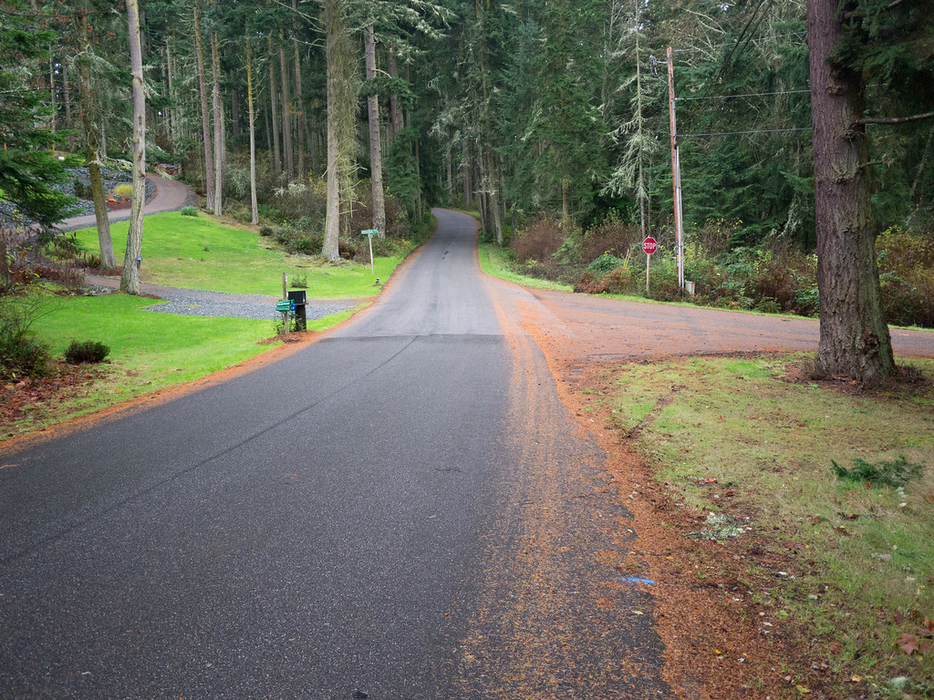
Waking up to rain is not a great start, so when it happens, I generally go back to sleep.  It worked this time!  The rain stopped, we got up, ate, broke camp and were on the bikes on a nice paved section by 9:30am.  The first part of the ride was a welcome relief from the day before on the bumpy OC&E, but we knew it wouldn’t last long.

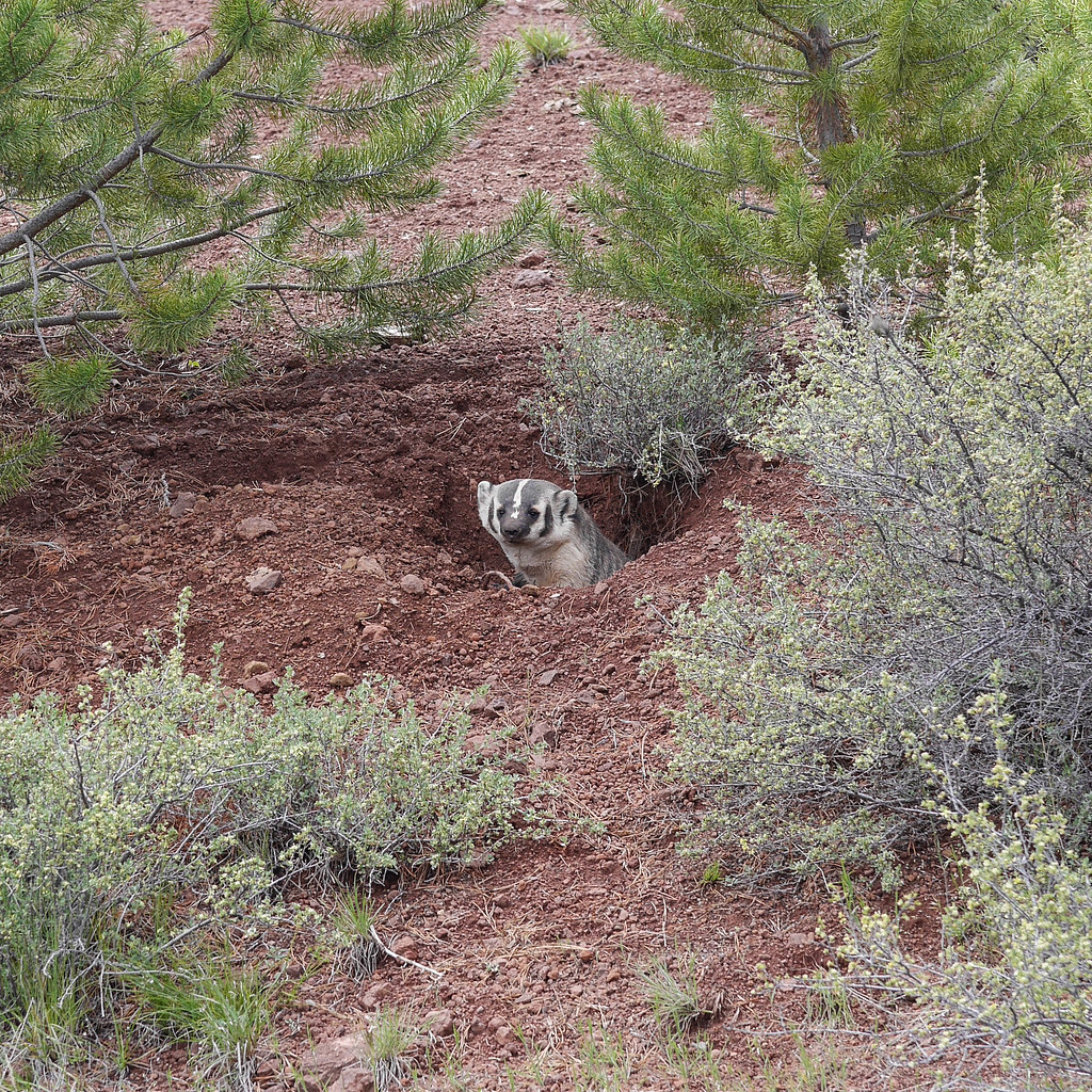
Our first surprise came when we surprised a badger who had made a den right on the side of the road.  With some trepidation, I went back for the photo opp as we were cruising when he popped out.
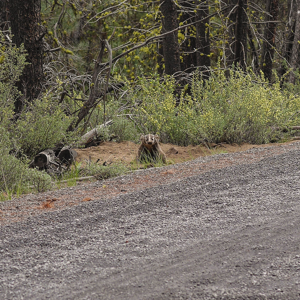
Say “meat!”

He seemed curious, but we stayed well away.  He looked to be about the size of my dog (40 lbs) but likely much more fierce.  Onward then.  Lots of washboard road this day.  It helped that dozens of folks had already been through on bikes.  We had a nice, packed trail to follow most of the time.

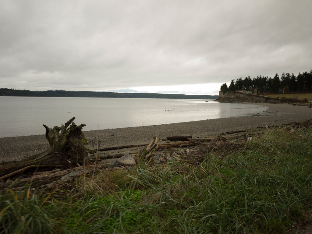
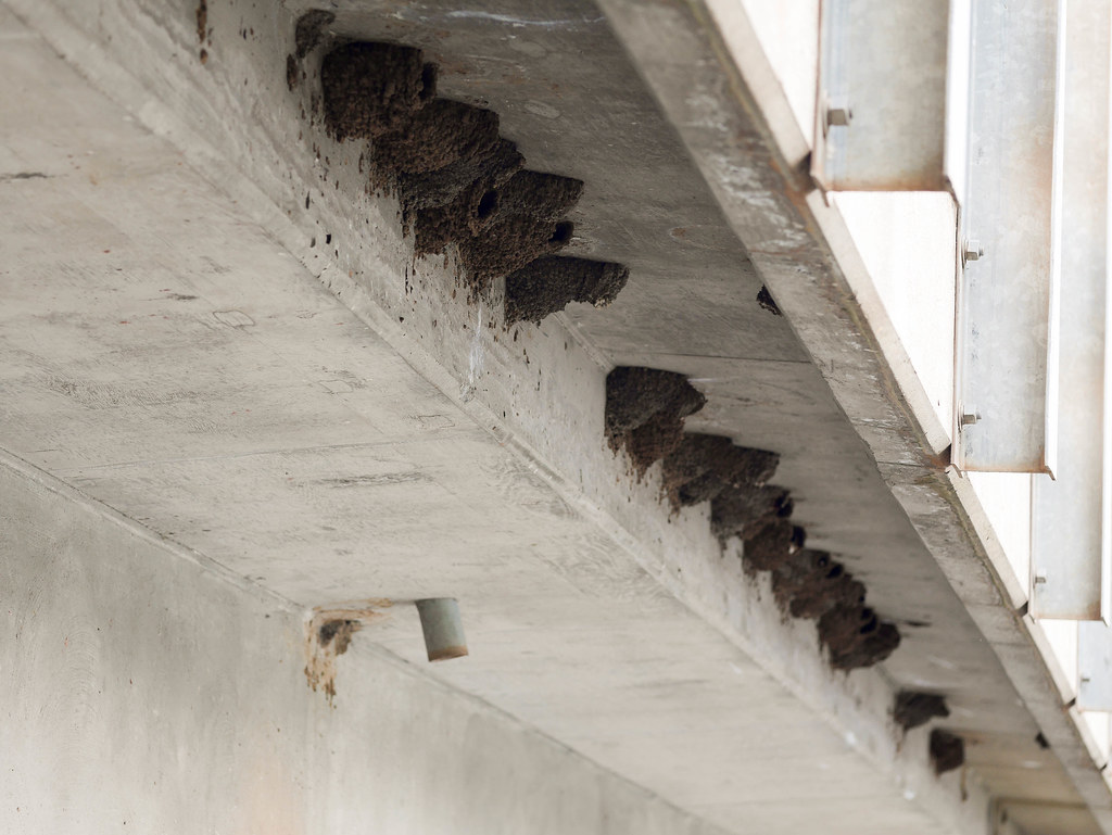
We had filtered 2 liters from Fivemile Creek at the beginning of the day.  The only town we would pass through was Silver Lake at the 50-mile point, and we didn’t know the state of the rivers, though with the recent rain, we probably ended up carrying too much water most of the time.  We stopped around 11am at a picturesque bridge with a ton of swallow nests to refill for the haul up to town.

BH-27.jpg

BH-26.jpg

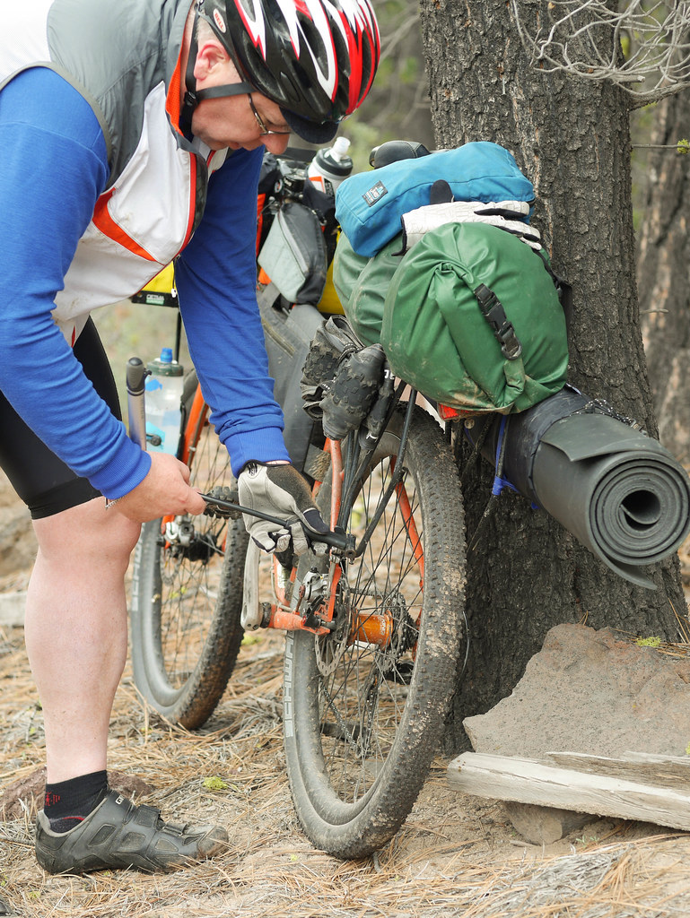
Shortly after 11:15am, John’s rear tire sprung a leak.  Similar story to the day before.  Rear tire (of course), but with some careful pumping and spinning, we got it to hold air.  Tubeless – 2, flats – 0.

BH-28.jpg

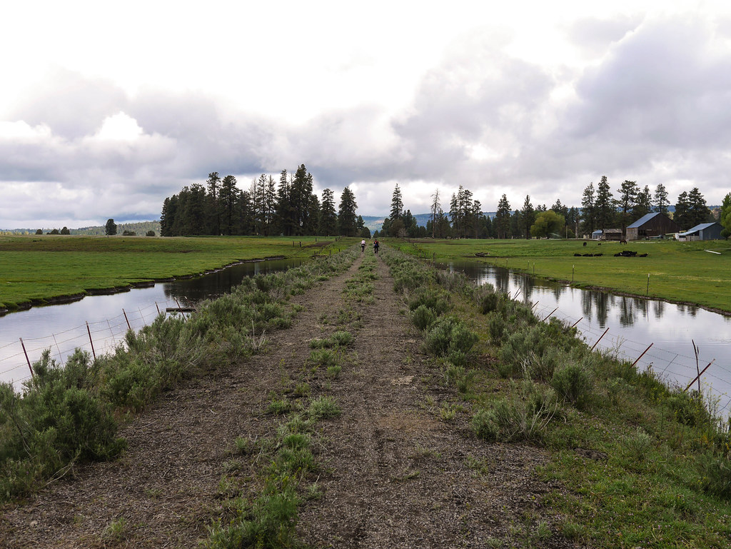
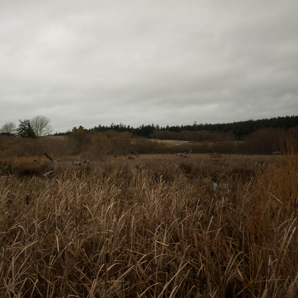
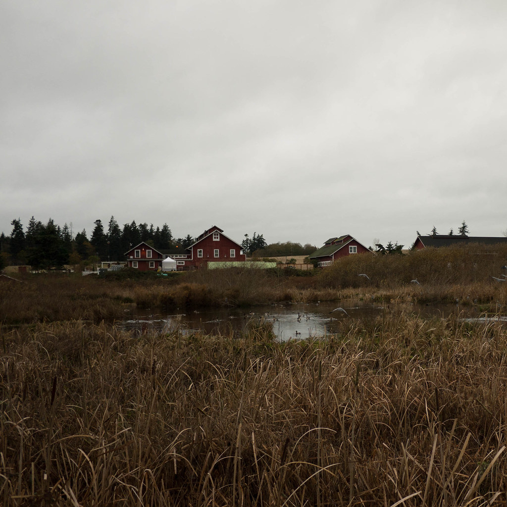
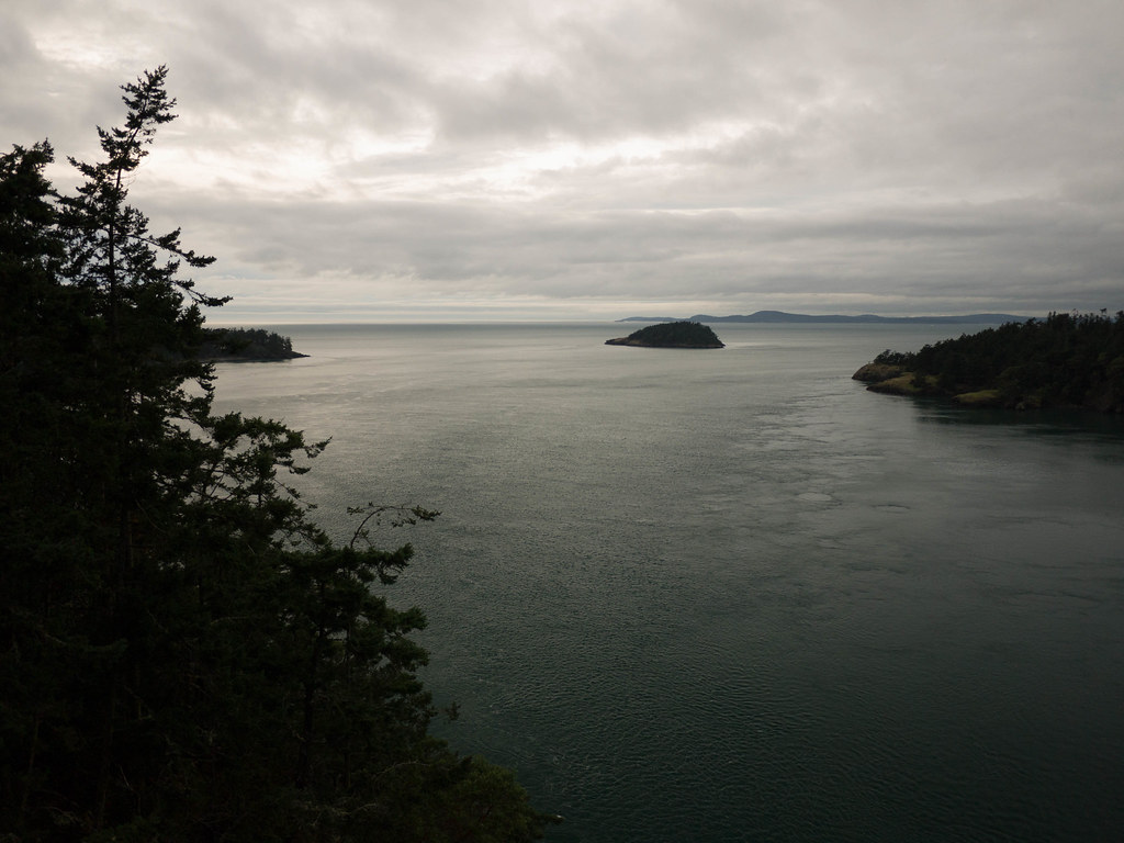
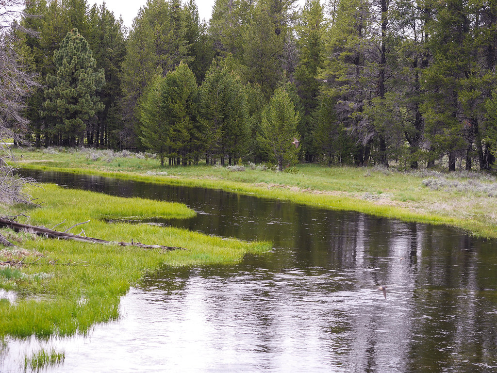
This was another partly cloudy, forested day.  The scenic level was high as we meandered past the Sycan Marsh area and stopped on a flat spot for our lunch.  The first couple days we generally had an oatmeal and hot chocolate breakfast, and salami and cheese for lunch.  We also snacked throughout the ride on various healthy snacks including gorp, seaweed chips, coconut bars and plenty of filtered water.

BH-29.jpg

We managed to stay dry, and at 1:30pm, we came upon our second badger of the day.  This one was seen scampering across the road in the distance, and we didn’t really know what it was until we rolled up nearby and saw the den.  He was smaller, but just as photogenic!

BH-30.jpg

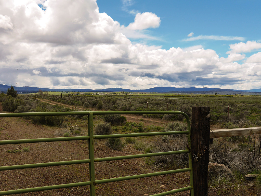
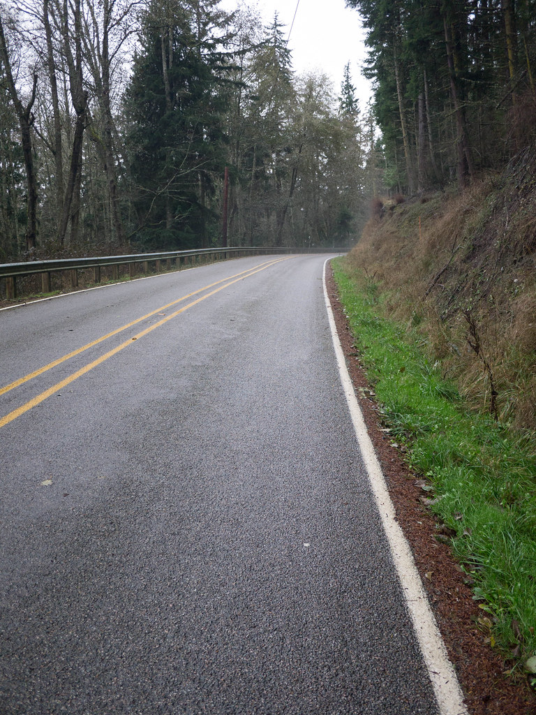
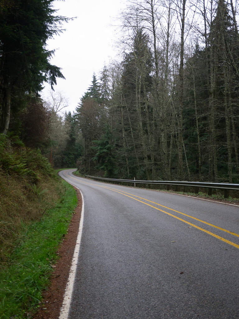
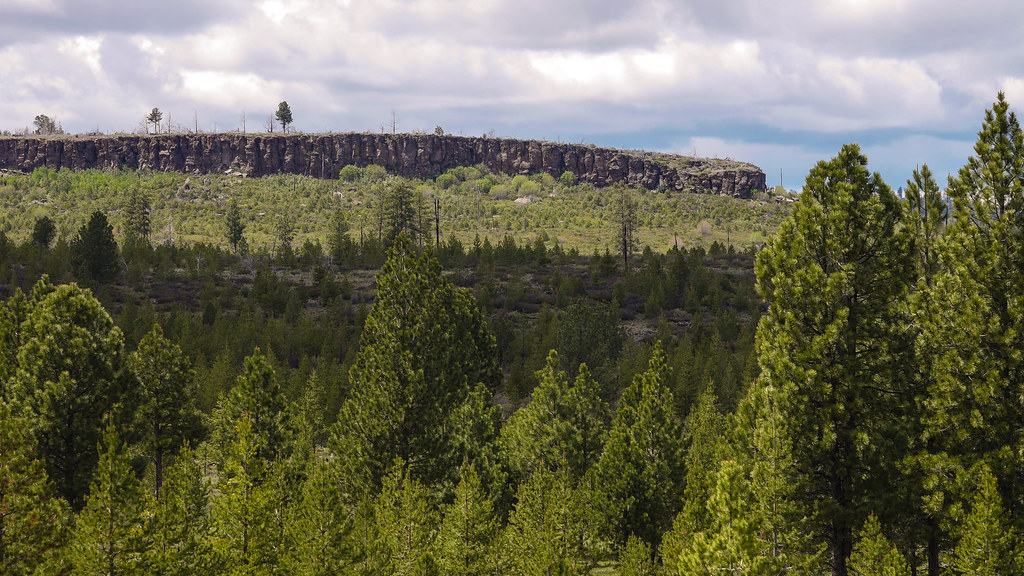
We started to get into the red pumice part of the ride.  The roads were pretty packed from the moisture, so riding was not a problem here. Pretty road – no traffic whatsoever.

BH-35.jpg

BH-33.jpg

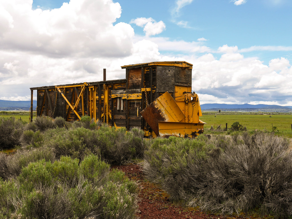
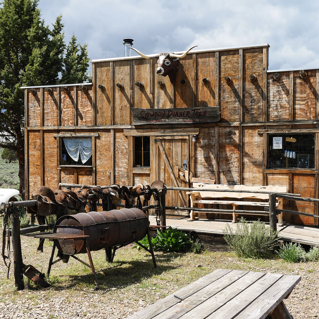
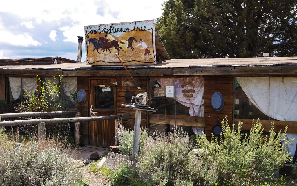
The fabled Cowboy Dinner Tree was in this section, and we rolled in around 3:30pm. No reservations, so I took some photos, and we pedaled on.

BH-36.jpg

BH-37.jpg

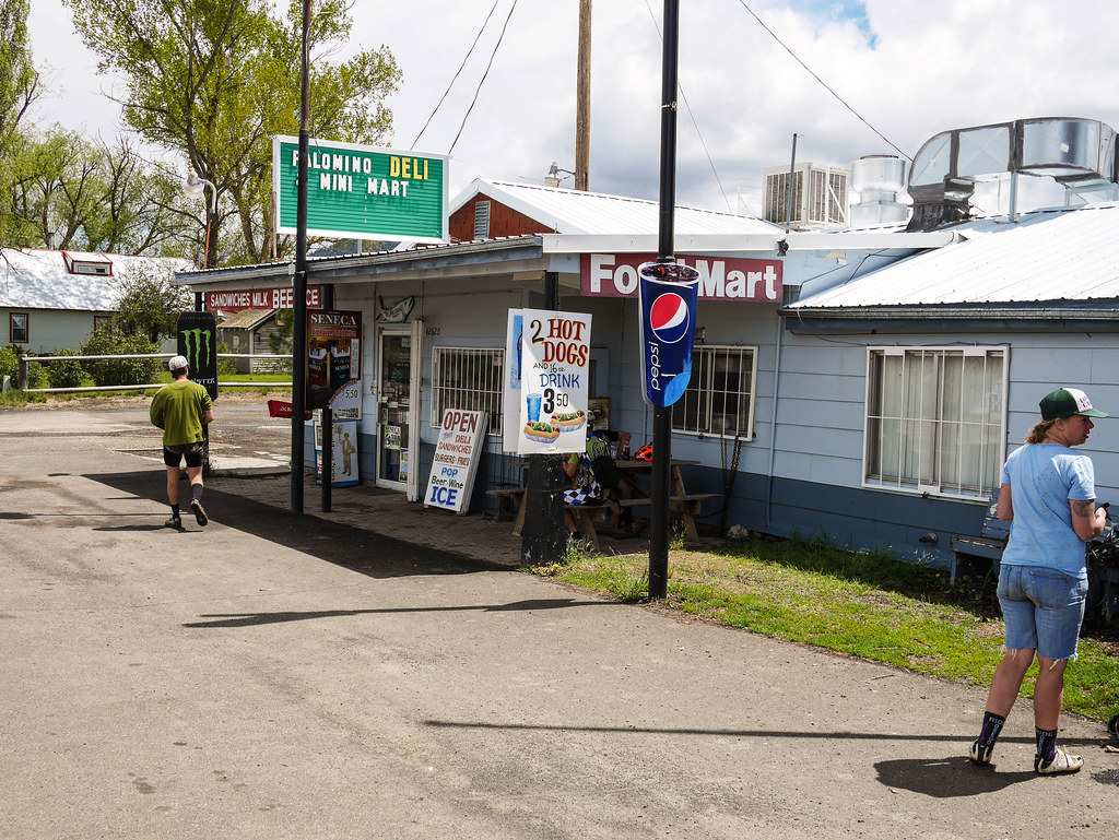
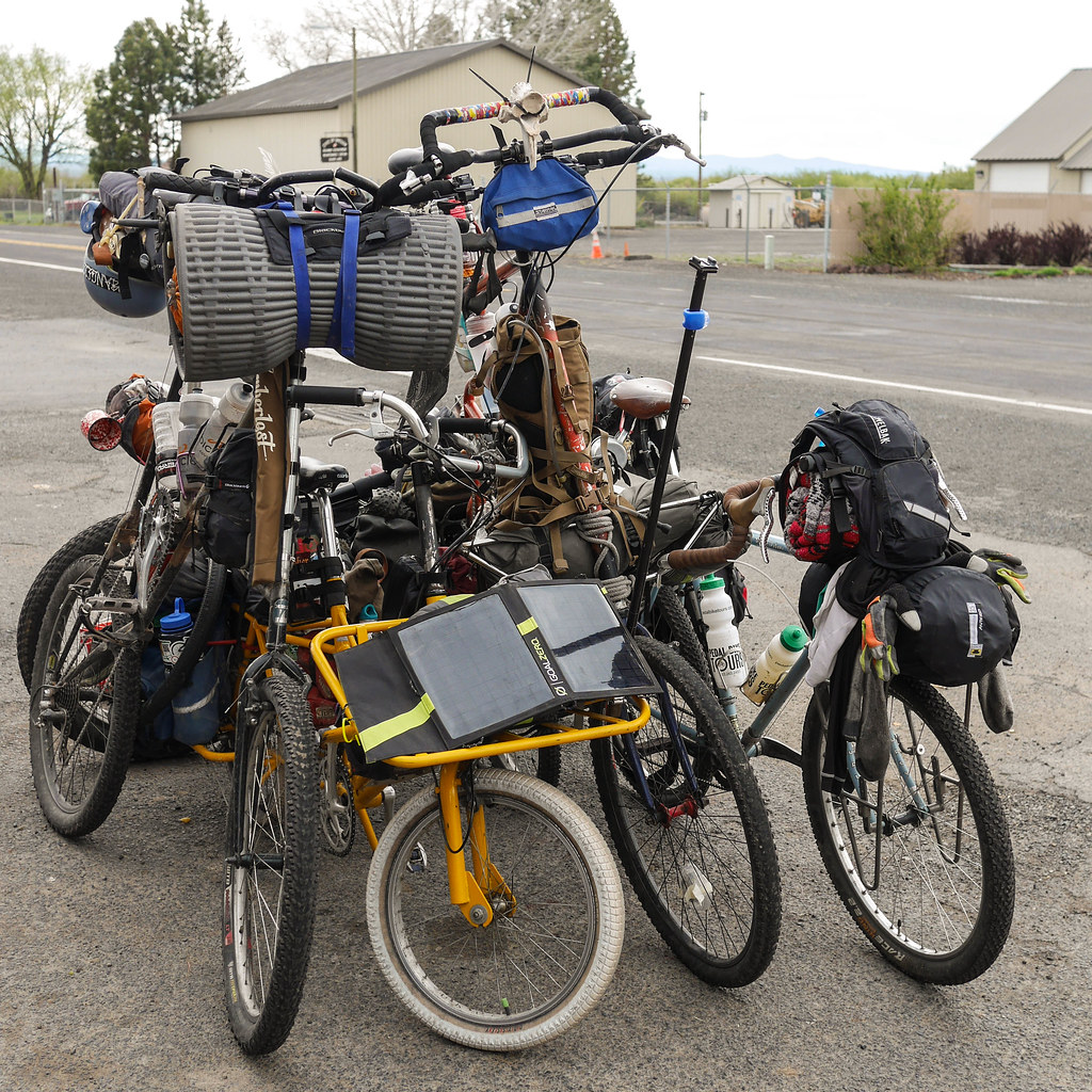
We rolled into Silver Lake in time to catch a couple guys on tall bikes. They had left a few days earlier, and were making pretty good time.  My bud Colin from last year’s Entmoot ride was there with his solar-power-charging-stationed Cycle Truck, which made a great tall bike kickstand.  It’s amazing who you meet in the middle of nowhere.

BH-38.jpg

The proprietor of the local store said the guys that were racing had been through the night before looking hypothermic in not much more than lycra.  They had gone through a couple thunderstorms with hail, and were looking worse for wear.  She had been worried about their health, but they managed to continue on.  Alas – no coconut helado bars, but we filled up our snack bags. and were soon on our way.  The remainder of the day was a fairly long flat slog for about 8 miles on Pitcher Road.

BH-40.jpg

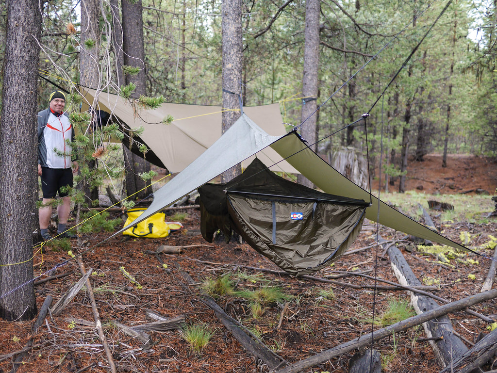
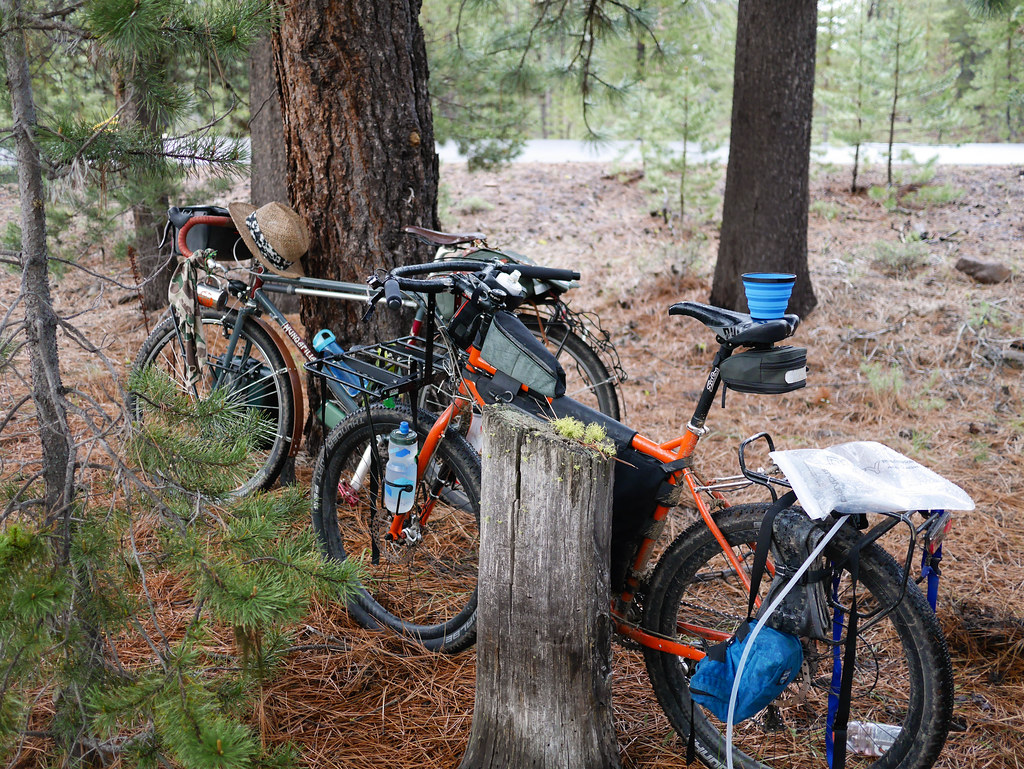
We saw a few vehicles on this stretch, and I just tucked in behind John “leg of ox” Halunen after taking a feeble attempt at leading.  We found the “last of the trees” for our hammocks on a small rise before Fort Rock, and made camp in a small turnoff.

BH-41.jpg

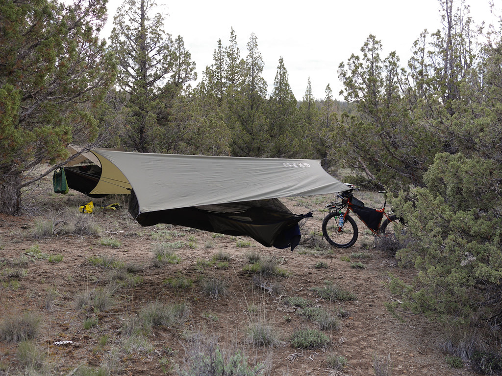
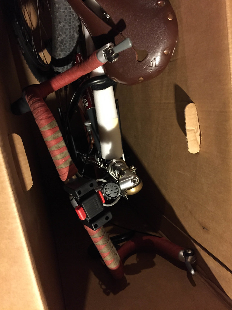
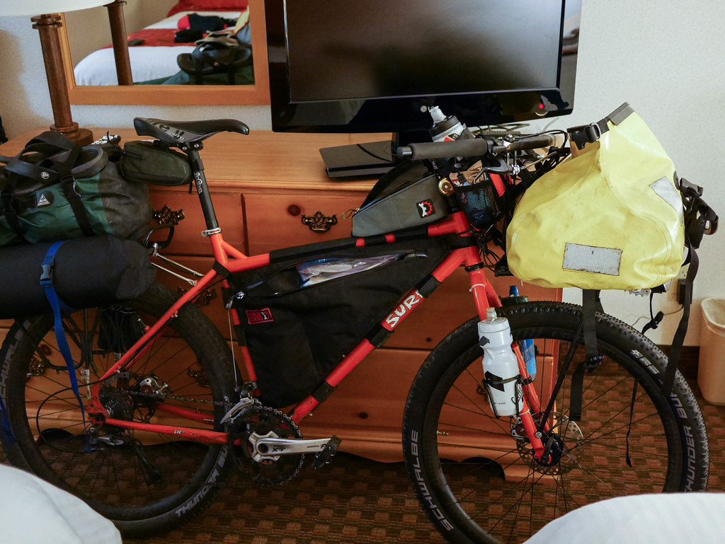
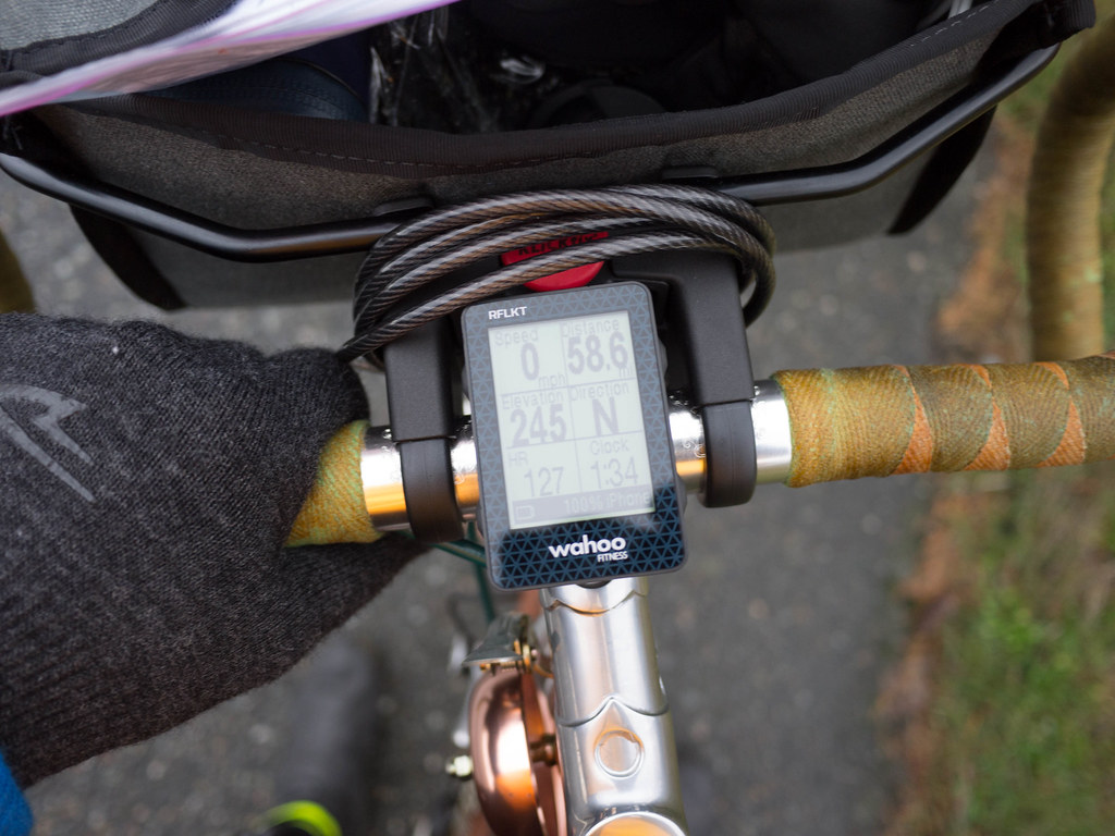
It was here that I learned that having my head too low was not a workable sleep situation (see pic above).  I ended up sleeping pretty poorly that night. Perhaps the bones and the sounds of coyotes exacerbated the blood rushing to my head?  That or the last of the bourbon? There were several types of animal remains in the immediate area. This really added to the western outback feel.

BH-44.jpg

BH-42.jpg

BH-43.jpg

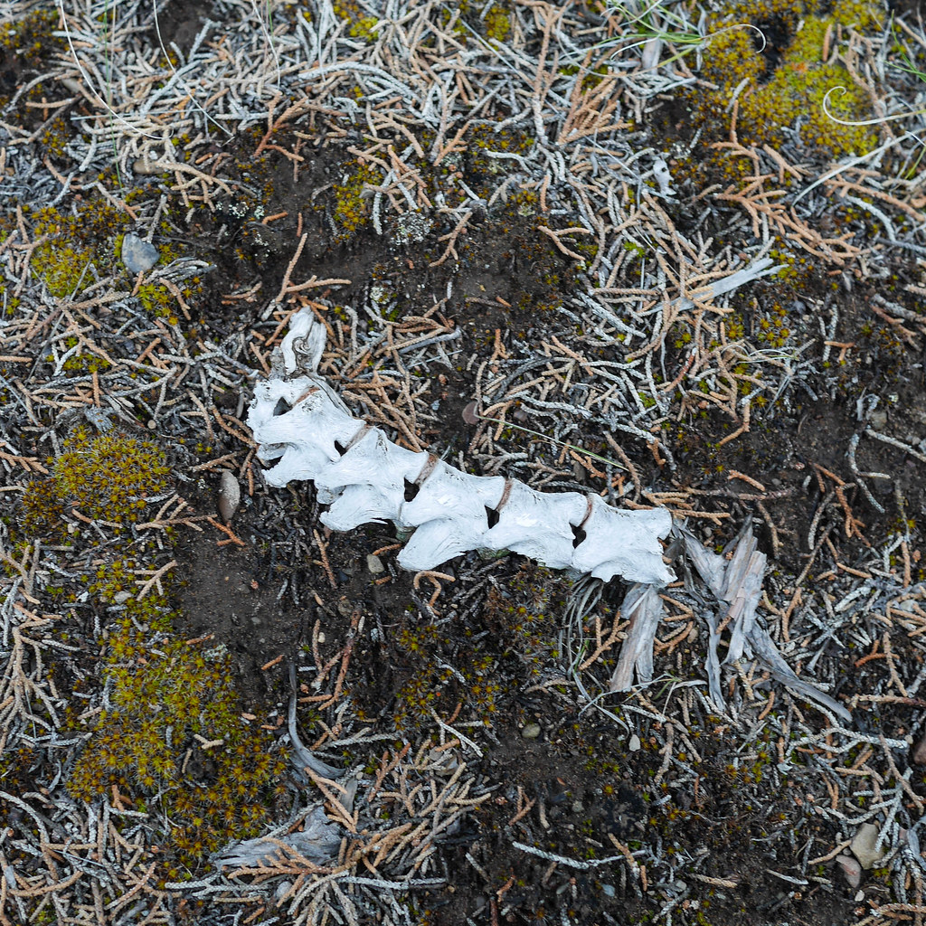
– Dubbed – Camp of Bones

Route and Map – Day 2

43.127847 -121.048099

Posted by Brian Hanson | Filed under Cycling

≈ Leave a comment

Image

Oregon Outback 2015 – Day 1

07 Sunday Jun 2015

Tags

bike touring, gravel grinding, Gravel Touring, hammock, Hammock camping, Hunqapillar, OC&E rail trail, Oregon Outback, rivendell, Surly Troll, touring, western backroads


I have a lot of photos from a recent adventure, so I’m going to break up this post into riding days.  At the end, I’ll try to sum up several things that worked really well, and what it took to get ready for an offroad tour.  Onward!

I haven’t been as excited for a trip in years.  The Oregon Outback travels through a lot of area I’ve never seen.  For good reason – there aren’t many roads that bisect it.  I had an inkling of the terrain, but what it would really require or be like was still unknown.

With lingering doubts about knee pain, soft shoes with flat pedals, and lightweight tubeless tires, I set out for adventure. These sort of epic trips generally come with solid learning experiences.  The first one happened when we arrived at the train station in Seattle with nicely packed bike boxes, carrying our bike baggage.

Boxed and ready

After we checked the bikes, we noticed there were four or five bikes that were being wheeled around the lobby with everything put together and be-bagged. Wow. I wanted to go back and un-check our boxes.  That would have saved us an hour up front packing the bikes.  Not to mention the re-build at the end of the journey…

The train ride out of Seattle was nice, going mostly alongside the Puget Sound and the Columbia River before moving more inland at Portland.

Bridge view

The Coast Starlight!

When we reached Klamath Falls, OR, we waited as 100+ ready-to-go bikes were handed down to their owners to be immediately ridden away. After carefully putting on the front rack, bags, and straightening the bars and stem in the dark railroad yard at 10pm, we rode over to the Olympic Inn for a short rest before the 7am start.

Pack’n

Surly Style

In the morning we double-checked our packing job, and then ate a good breakfast that included oatmeal, biscuits and gravy, and eggs.  At a bit after 7am, we were off.  The forecast was for rain and scattered thunderstorms.

Rain ahead

The OC&E is a great trail.  Nice and flat, but with a fair amount of cow deposits and cattle gates, the going was flat, messy, and interrupted.  At this point in the ride, we  were still seeing a fair amount of riders, but as the day wore on, we quickly spread out and found ourselves with lots of quiet time to think.

One of the many – open/close

At one of the 40+ cattle gates, I noticed my rear tire was losing air.  I stopped and pumped it up.  The hole was obvious, losing some of the sealant (Stan’s), but it didn’t seem too bad, so I spun the tire, put the hole at the bottom, and pumped it up again.  We rode on a few more gates, and it started holding air.  After bringing it back up to 40psi, I never had to gas it again.  Now that’s what I’m talkin’ bout!

One of the food highlights of the first day during a rare warm sun break was a brief stop in Beatty, about a mile off the trail.  We had coconut helado ice bars.  I was looking for them at every stop for the rest of the trip.

Coconut Helado, I love thee!

The OC&E steadily turned more remote, and less groomed.  The trail was great, but more grass was on the trail as we got further north/east.  After a good climb up an old railway switchback, we stopped for the view and some water.  It was misting at this point.

Misty low pass

We were entering ranch country.  No towns were bigger than a few houses, and perhaps a post office.  It was never-ending ranch lands with few roads or access.  This is the real west!

Relic

Lost tracks

We lasted about 7 hrs of moving time for about 72 miles.  We both felt pretty good and set up camp in between showers right where we were hopping off the trail.  There was a river nearby, so we knew we had water for the next part of the journey.

Up off the wet ground – Hammocks for the win!

John said it poured on us at 2am, but I heard nothing.  I never knew sleeping in the woods could be so comfortable.  To be continued…

Ride With GPS Route Info – Day 1

Posted by Brian Hanson | Filed under Cycling

≈ Leave a comment

Image

First Prep Ride

05 Sunday Apr 2015

Tags

bikes, Gravel Touring, Oregon Outback, Rivendell Hunqapillar, Schwalbe Thunder Burt, Surly Troll, Whidbey Island


I’ve been planning to do the Oregon Outback ride this year with a friend, and yesterday was our first trial ride with our camp bikes.  We did the 26-mile mostly paved ride I had done on my rando bike a few weeks ago.  There is a short stretch of gravel, so it allowed us a bit of feel for the twisty dirt roads, but this was mainly an equipment shakedown.

Testing the OO setups

We loaded up his Troll and my Mammoth with some bulk, but not a full level of kit. I had the hammock, sleeping bag, and stove, and John had a front bag, frame bag, and a full Ortlieb dry bag. All in, my bike was probably 10+ lbs heavier than my last ride on this loop.

John's Troll

Observations:

  • The Thunder Burts are nice pavement tires – minimal buzz, and great float, and the tubeless setup is holding air nicely
  • I will likely need to put my rear rack back on to support the bag – it rests on the fender, and there will be more weight out back when I add food, clothes, etc…
  • I’m going to put a triple on the front for the extreme climbs with weight – the 48/34 compact double is good, but I want more granny
  • John is checking his chain rings – threw the chain a few times
  • Flat pedals rock
  • Ready to tape the bars – they felt fine on the ride
  • Both bikes had a bit of shimmy at ~20mph – attributed to more weight high up in the back – we should be able to sort it by adding weight in the front, and lower down
  • Our speed was not too different then my solo ride of the reverse loop;  12.3 mph ave vs. 13.7 mph ave – only took an additional 12 mins over the course of 2 hrs
  • The bikes are plenty comfortable
  • I can’t wait for this trip!


stonehog-2.jpg

stonehog-1.jpg

Posted by Brian Hanson | Filed under Cycling, Enduro Offroad, Northwest, Randonneuring

≈ 2 Comments

Image

Europe

15 Sunday Mar 2015

Tags

europe, glasgow, london, oban, scotland, stockholm


I’ve been away from the blogging lately due to a heavy work schedule.  I have missed the first few rides with SIR this year, as well.  I’ve been commuting a few times weekly, and plan to up that as I get my Hunqapillar set up for the Oregon Outback.

BH-91.jpg

I was in Europe a few weeks back on work meetings, and managed to get to Scotland for a weekend vacation.  From a flight into Glasgow, I hired a car and drove to Oban to stay at a bed and breakfast for 2 nights.  I didn’t get any biking in, but did a lot of walking about.  The main draw for me was the landscape and whisky distillery.

BH-24.jpg

I managed to get a few bike pics in Stockholm, Sweden.  It was the only place I noticed much biking.  The weather was quite mild in early March – I had assumed it would be frozen and snowy, but it seems not unlike home.

BH-109.jpg

I also noticed a few mail carriers using bikes.

BH-110.jpg

As for London – more cars than ever it seems.  I met a few friends who biked to the local pub, but I only noticed a few bikers braving the busy city streets.  They seemed to be very comfortable getting close to traffic – just not as much room on the streets there. One of these days I’ll have to rent a bike and do a bit of cycling.  The roads are inviting – especially the less busy rural roads of Scotland.

BH-81.jpg

Posted by Brian Hanson | Filed under Cycling

≈ Leave a comment

Image

Late Season Permanent

29 Saturday Nov 2014

Tags

200k, a. homer hilsen, ahh, bicycle, bike, brevet, SIR, Whidbey Island


I saw the opportunity and took it.  I’ve been meaning to try a ride around Washington State’s largest island since I’ve been coming up here in 2003.

My wife and I fell in love with Whidbey Island at some point, and we’ve had properties here twice in the last 11 years.  Last week, I decided to take the holiday week off, and spend some time up here.  Now “up here” is a mere 35.7 miles from “home” in Seattle, so I feel a little funny going up to the cabin, as we say in Minnesotan.  This is less distance than a lot of folks commute to work every day!

When I was growing up, a trip to the “cabin” in northern Minnesota was a 4 hour trip one-way.  It was always the last half hour past Brainerd that I really felt like we were getting out of dodge.  Now it’s just a short drive north that takes a bit over an hour, and I’m in another world, my happy place. The ferry ride helps.  Once you get off the boat, it’s sort of another planet from the urban/suburban bustle of Seattle. There are large tracts of forest, farmland, and a few small picturesque towns dotting the island.  A lovely place, really, and it just feels sleepy and awesome!

Anyway, on to the ride.  The last brevet I had done was a mean, rainy 300k at the end of March.  A long, long time ago.  Now I’ve been commuting plenty, and had several 50-80 mile weeks going, so I felt that stepping up to the 126 mile 200k was reasonable, and my fitness was still good.  I also tried to ignore the little bird telling me that this ride had over 7500′ of climbing.  I figured that this was just a few more hills than a more normal 200k.

//ridewithgps.com/trips/3818194/embed

I thought I would be well prepared.  I brought both my rando bikes up with plans to ride the A. Homer Hilsen.  I wanted to make sure the shimmy was gone, and the Swift bag worked well on a longer ride.  I had most everything packed up and ready the night before, and got plenty of sleep knowing I had a big day in front of me.  In the morning, I made eggs and coffee, and still managed to get down to the ferry dock around 8:15.  I had set my start time for 8am, so I was already running late.  After a few more minutes of figuring out where I could leave the car all day, I parked and was off at just past 8:30am.

BH-1.jpg

Then I started climbing.  The first hill off the ferry wasn’t too bad, but they seemed to just keep coming.  I was happy I had a 34 big ring on the cassette, so I had extra granny help.  Entering Langley – a small town with an artsy vibe, I wanted to stop at the local coffee shop, but I wasn’t ready for a break.  I had packed a rain jacket, camera, phone, wallet, and a few food items in the Swift.  I had my tool bag under the seat.  I felt that I was packing light, but I did have 3 full water bottles.  I wasn’t into the photo mode yet, but couldn’t help but take a snap of the local museum.

BH-2.jpgAs I rode on towards Freeland, I wondered if I had too much.  The weather was great, and my thin wool undershirt, SIR jersey (also wool), and reflecto vest were keeping me toasty.  There were lots of eastern beach vistas on the high bluffs to keep me occupied, and there were about 3 cars that passed me in 10 miles.  No traffic to speak of, which held true most of the day.  The roads were also glorious!  Smooth, fresh blacktop that looked to be laid in the past year or two.  These islanders keep there roads up really well.  That said, I started noticing the many squashed slugs, as well as some small orange salamanders.  1000 slug trails seemed an apt ride name.

BH-4.jpg

BH-5.jpg

I hit my first walking hill just after Freeland. Resort Rd. climbs back up to HWY 525, and at 10%, it was a bit much. It gave me a chance to stretch my legs. A nice walk in the woods, really – no traffic at all.

BH-6.jpg

The first jaunt on the main island highway was a nice few miles downhill. I was doing 30 with the cars only going slightly faster. Greenbank is a tiny town at the thinnest part of the island, where if you stand on the field by Greenbank Farm (an old loganberry farm), you can see both Saratoga Passage to the east, and Admiralty Inlet to the west. Here, I stopped to photo what turned out to be 20 herons resting/hunting in the marsh below the farm. They all took off when I circled back to get a photo.

BH-7.jpg
BH-8.jpg

Onward – I still had a long way to go. The next walking hill was Rhodena Rd. at about an 8% grade just before Parker. This one was a bummer, but it was in another pretty area.

BH-10.jpg

I realize that all these hill pics look flat, but believe me, they went UP!!! Phew – made it to Coupeville on some nice twisty roads. This is a Washington’s second oldest town, founded in 1853 by a guy who evidently was the only person to have sailed through Deception Pass with wind power alone. X-Games circa a long f’ing time ago! Now I could nearly smell the halfway point.

BH-11.jpg

BH-12.jpg

BH-13.jpg

The aptly named Madrona Way around inner Penn Cove offered great views of the mussel farming rigs. This was one of my favorite rides, with light traffic, nice curvy roads, and great views of the cove.

BH-15.jpg

BH-16.jpg

After a wake-me-up short ride on HWY 20 with lots of cars ripping by, I was back on the easy streets heading into Oak Harbor. I stopped to get a few pics, but I was starting to worry about time, as i was taking pics, and my legs were starting to get tired. I wasn’t quite halfway yet, and I knew I would be fighting a headwind going back south. The forecast was for 15-25 mph gusts, and I was quite tired from the climbing. I had no idea how much of the southerly route echoed the hills on the east side of the island. It was already 1:30, so I was 5 hrs into the ride, but not halfway yet. Hmmm…

BH-17.jpg

BH-19.jpg

BH-21.jpg

After a few more hills, and some duck hunters on Dike Rd. I stopped for a bathroom break a mile from Deception Pass. This was technically past the halfway point, but I didn’t consider it that until I was at the top of the island. I had a reuben and some “power milk” and this picked me up. At the Pass, I watched a seal swimming around the kelp in the shallows. This is a beautiful spot with a high bridge over fast-moving bright green water famous for their whirlpools and standing waves during tidal surges.

BH-22.jpg
BH-23.jpg
BH-24.jpg

This was the turnaround point.

BH-25.jpg

Next stop was Ault Field after a jaunt down the highway again. This wasn’t too bad, but I was ready to get off the main road for a while.

BH-26.jpg

The Navy evidently put their air station on Whidbey partly due to it being in the “rain shadow” of the Olympic Mts. I just figured it was due to the natural beauty – a great place to fly over if you ask me. Just past Joseph Whidbey State Park (closed) it was starting to get dark. There was a great big hill climb here, and halfway up, I noticed writing on the road, “Legs Up Shut” – ahhh, there have been cyclists before me on this! The infamous Jens Voight “shut up legs” quote. That was a major pick up for me, and got me to the top of another 400 foot hill.

BH-27.jpg
BH-28.jpg

I’m not going to lie to you. I thought about shortening this ride many times over the course of the 12 hrs on the bike. As I got closer to the end and realized I would make the 13.5hr 200k time limit, I knew I had to finish, but every time I went by one of the Island Transport stops on the highway, I thought hmmm…

I made a stop at the Keystone Ferry south of Coupeville for another bathroom break. A bit further south at South Whidbey State Park, I filled out my control card while standing in the dark entrance by the street. At this point, I found that I really liked Clif Shots gummy energy bar nuggets! Yum – there is nothing like junk when you are feeling tired. The tiny bits of rain were good at keeping me focused, but really it was just a long old slog back down to Clinton.

I had one more walk up Lancaster hill, but that was short-lived, and the last few miles were mostly a cruise along the summit of the hills of south Whidbey. The ride back down to the car was awesome! I had a bikers high for the rest of the night thinking about this great day in the saddle and everything I’d been able to see on the way. Pretty cool way to spend a day off.

Special thanks to a very special wife and daughter for giving up Dad on the day before turkey day!

Posted by Brian Hanson | Filed under Cycling, Randonneuring

≈ 7 Comments

← Older posts
Newer posts →

Flickr Photos

BH-68.jpgBH-67.jpgBH-66.jpgBH-65.jpgBH-64.jpgBH-63.jpgBH-62.jpgBH-61.jpgBH-60.jpgBH-59.jpg
More Photos

Archive

  • August 2020 (1)
  • March 2018 (1)
  • January 2018 (1)
  • July 2017 (1)
  • June 2017 (1)
  • May 2017 (1)
  • February 2017 (1)
  • December 2016 (1)
  • November 2016 (1)
  • August 2016 (2)
  • March 2016 (1)
  • January 2016 (6)
  • December 2015 (2)
  • November 2015 (1)
  • June 2015 (5)
  • May 2015 (1)
  • April 2015 (1)
  • March 2015 (2)
  • January 2015 (2)
  • December 2014 (2)
  • November 2014 (2)
  • October 2014 (2)
  • September 2014 (2)
  • August 2014 (1)
  • July 2014 (1)
  • June 2014 (1)
  • May 2014 (2)
  • April 2014 (5)
  • March 2014 (4)
  • February 2014 (4)
  • January 2014 (6)
  • December 2013 (1)
  • November 2013 (2)
  • October 2013 (2)
  • September 2013 (1)
  • August 2013 (1)
  • July 2013 (2)
  • May 2013 (6)
  • April 2013 (1)
  • March 2013 (6)
  • February 2013 (2)
  • January 2013 (7)
  • December 2012 (5)
  • November 2012 (2)
  • October 2012 (2)
  • September 2012 (3)
  • August 2012 (3)
  • July 2012 (1)
  • June 2012 (4)
  • May 2012 (7)
  • April 2012 (1)
  • March 2012 (1)
  • February 2012 (4)
  • January 2012 (5)
  • December 2011 (6)
  • November 2011 (4)
  • June 2011 (2)
  • May 2011 (4)
  • March 2011 (2)
  • February 2011 (4)

Enter your email address to follow this blog and receive notifications of new posts by email.

Join 96 other subscribers

Blog at WordPress.com.

  • Subscribe Subscribed
    • Cycle Seattle
    • Join 96 other subscribers
    • Already have a WordPress.com account? Log in now.
    • Cycle Seattle
    • Subscribe Subscribed
    • Sign up
    • Log in
    • Report this content
    • View site in Reader
    • Manage subscriptions
    • Collapse this bar